Bernier River (Saint-François River tributary) facts for kids
Quick facts for kids Bernier River |
|
|---|---|

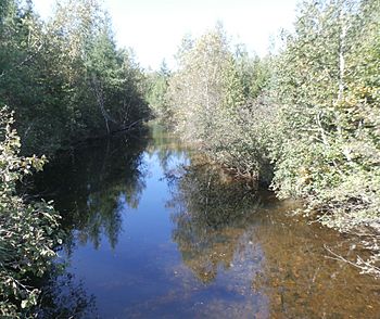
Bernier River (Maskinongé) downstream from the Highway 161 bridge near Stratford, and very close to the Maskinongé Marsh.
|
|
| Country | Canada |
| Province | Quebec |
| Region | Estrie |
| Regional County Municipality | Le Granit Regional County Municipality |
| Physical characteristics | |
| Main source | Maskinongé Lake (Frontenac National Park) Stratford 293 m (961 ft) 45°46′41″N 71°14′43″E / 45.778141°N 71.245354°E |
| River mouth | Saint-François River Stratford 248 m (814 ft) 45°46′52″N 71°20′35″W / 45.78111°N 71.34306°W |
| Length | 10.5 km (6.5 mi) |
| Basin features | |
| Progression | Saint-François River, St. Lawrence River |
| Tributaries |
|
The Bernier River is a cool waterway located in Quebec, Canada. It flows through the town of Stratford in the Estrie region. This river is a branch, or tributary, of the larger Saint-François River.
Like many rivers in Quebec, the Bernier River freezes over in winter. It's usually covered in ice from mid-December until the end of March. If you want to walk on the ice, it's generally safe from late December to early March. The amount of water in the river changes throughout the year, depending on the seasons and how much rain or snow falls.
Where the River Flows
The Bernier River is part of a larger water system. It collects water from the areas around it. Here are some of the places that share their water with the Bernier River:
- To the north: The Saint-François River.
- To the east: Maskinongé Lake and some smaller streams like Troisième and Jackman.
- To the south: The rivière au Rat.
- To the west: Elgin Lake and again, the Saint-François River.
River's Starting Point
The Bernier River begins its journey in a natural forest area. Its source is a beautiful spot called Maskinongé Lake (Stratford). This lake is located near the edge of Frontenac National Park. Maskinongé Lake is shaped like a triangle and is about 2.4 kilometres (1.5 mi) long. It's surrounded by mountains, making it a very scenic place.
The River's Path
From Maskinongé Lake, the Bernier River flows for about 10.5 kilometres (6.5 mi) until it reaches the Saint-François River. Along its way, it passes by interesting landmarks:
- It flows westward, crossing Highway 261 near the village of Stratford.
- It picks up water from other small streams, including one that runs through the village.
- The river then passes south of the village and north of Mont Aylmer.
- It continues its journey, collecting water from more streams.
- Finally, it reaches the outlet of Elgin Lake. This lake is also triangular and has resorts around it, located west of Mont Aylmer.
- After Elgin Lake, the river flows a short distance further to its mouth, where it joins the Saint-François River.
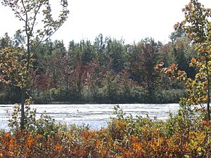
The Bernier River also flows through a special area called a marsh. This marsh covers about 25 hectares (that's like 25 football fields!). It's a "swamp and swampy stream" area that leads into a bay on the south shore of Lake Aylmer. The Saint-François River also crosses Lake Aylmer. There's even a path that leads to a special center where you can learn about the marsh, and a trail called the Maskinongé Marsh Trail.
What's in a Name?
The name "Bernier" is a family name that comes from France. It's a common name in many parts of Quebec.
The name "Bernier river" was officially recognized on December 5, 1968, by the Commission de toponymie du Québec. This commission is in charge of naming places in Quebec.


