Beryl, Utah facts for kids
Quick facts for kids
Beryl, Utah
|
|
|---|---|
| Country | United States |
| State | Utah |
| County | Iron |
| Named for | Beryl |
| Elevation | 5,154 ft (1,571 m) |
| Time zone | UTC-7 (Mountain (MST)) |
| • Summer (DST) | UTC-6 (MDT) |
| ZIP codes |
84714
|
| Area code(s) | 435 |
| GNIS feature ID | 1437500 |
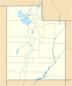
Beryl is a small, unincorporated community located in west-central Iron County, Utah, United States. Being "unincorporated" means it's not officially a city or town with its own local government. Instead, it's part of the larger county.
Contents
What is Beryl Like?
| Historical population | |||
|---|---|---|---|
| Census | Pop. | %± | |
| 1940 | 122 | — | |
| 1950 | 239 | 95.9% | |
| Source: U.S. Census Bureau | |||
Beryl is a quiet place with a small population. In 2012, about 944 people lived in the area covered by Beryl's ZIP code (84714). This means there are only about 2 people living in each square mile, making it a very spread-out community.
The average age of people living in Beryl is around 31.6 years old. The average household in Beryl has about 3.13 people living in it.
Education in Beryl
The community has one school for younger students called Escalante Valley Elementary. This school is part of the Iron County School District, which manages public schools in the area.
How Beryl Got Its Name
Beryl was first started in 1901. It began as a "siding" for the Union Pacific Railroad. A siding is like a short extra track next to the main railroad line. Trains could use it to let other trains pass or to load and unload goods.
The community was named after a beautiful, semi-precious stone called beryl. This type of stone can be found in the area.
Understanding Beryl's Climate
Beryl has what is known as a semi-arid climate. This means the area is quite dry, but not as dry as a desert. It gets some rain, but not a lot.
On climate maps, this type of weather is often shown with the abbreviation "BSk" as part of the Köppen Climate Classification system. This system helps scientists categorize different climates around the world.
 | Chris Smalls |
 | Fred Hampton |
 | Ralph Abernathy |


