Bethel–Christian Avenue–Laurel Hill Historical District facts for kids
Quick facts for kids |
|
|
Bethel–Christian Avenue–Laurel Hill Historical District
|
|
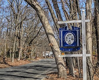
BCALHC sign Historic district
|
|
| Location | Christian Ave., Setauket, New York |
|---|---|
| Area | 7.5 acres (3.0 ha) |
| Built | 1848 |
| Architectural style | Classical Revival |
| NRHP reference No. | 100001808 |
| Added to NRHP | November 09, 2017 |
The Bethel–Christian Avenue–Laurel Hill Historical District is a special neighborhood in Setauket, New York, on Long Island. It was chosen in 2017 to be protected as an important historical place.
This area has a long history, going all the way back to the 1600s. It was a place where African-American people, who had been enslaved, and Native Americans from the Setalcott tribe made their homes.
The historical district includes two very important places: the Bethel AME Church and the Laurel Hill Cemetery.
Contents
A Look Back: Early History of Setauket
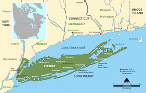
In 1655, settlers from New England bought land from the Setalcott Indians. They lived peacefully in an area that stretched from Stony Brook to Port Jefferson.
During the American Revolutionary War, Setauket Harbor was important because it was across Long Island Sound from Connecticut. In 1777, the British controlled New York City and Long Island. The American army tried to block them from getting supplies.
On August 21, 1777, Colonel Samuel Blachley Webb and his soldiers crossed Long Island Sound in small boats. They landed near Setauket and marched to the town. They tried to attack the British soldiers who were hiding behind walls around the Presbyterian church. The Americans couldn't break through the walls. They eventually went back across the sound, taking some horses with them. This event is known as the Battle of Setauket.
Laurel Hill Cemetery and Bethel AME Church
In 1815, a document shows that land along Christian Avenue was set aside as a cemetery for people of color. This place is still called Laurel Hill Cemetery. Since 1871, the Bethel AME Church has been in charge of it.
In 1848, land was given to the Bethel AME Church to build their first church. This original church was located in Stony Brook and was destroyed by fire in 1871. You can still see a line of stones that mark where its foundation used to be.
The church moved to its current location in 1871, and a new church building was finished in 1874. This new church also burned down in 1909 but was quickly rebuilt.
The Setalcott Indians and Their Community
Experts say this area is one of the last places that truly shows the history of African-American and Native American people on Long Island.
When Europeans first arrived in Setauket, the Setalcott Native American tribe was already living there. Their leaders, Warawakmy and Mahue, allowed the Europeans to use the land. Around 1670, Europeans also brought enslaved Africans to the area. Over time, Setalcott people and Africans married each other. Families like the Harts, Sells, Eato, Lewis, and others became a mix of Native and African heritage.
Most people in this community worked as servants or laborers. They built a strong and stable community. At that time, they were not allowed to live in other parts of the district. The church helped guide and unite them, creating a community separate from the white settlers.
Protecting a Unique History
The Bethel–Christian Avenue–Laurel Hill (BCALH) historic district was officially recognized in 2005. This was done to help save the history and culture of the people who still live there. The Christian Avenue community has a "distinct and indigenous way of life" that has lasted for hundreds of years in Setauket.
Around 2007, this community felt threatened. So, a group was formed to get more recognition for the area. With help from experts at Stony Brook University, they gathered and organized important historical documents. Many homes in this district, mostly belonging to Native and African American families, were not protected by any preservation laws.
As Setauket became more developed in the late 1900s, some of these historic homes were sold and torn down. This caused their history to be forgotten. To fight this, community members, school groups, and college students started a project called 'A Long Time Coming'. Their goal was to help the BCALH community stay in their homes. They wanted to prevent them from being forced out by rising taxes and new developments, which has happened to other historic minority communities across the United States.
Chicken Hill: A Diverse Neighborhood
From 1867 to 1960, the community was known as Chicken Hill. It was a one-square-mile area on Christian Avenue, with the A.M.E. Church at its center. At one point, it was one of the most diverse communities on Long Island. It had a mix of Native Americans, African-Americans, and immigrants from Eastern and Western Europe.
A piano factory, which later became the Brookhaven Rubber Company, employed many people. This factory was the largest employer in Suffolk County. Many of its workers were Irish and other European immigrants who had moved from New York City.
The Christian Avenue School was also part of this community. Its original buildings were used for kindergarten and first grade. They closed in the late 1970s and were later replaced by homes in the 1990s.
The BCALH historic district is special because it recognizes both the historical and cultural importance of this mixed Native and African American community. The district includes the Laurel Hill Cemetery, the church, an American Legion building, and 30 homes.
It's important to know that the Setalcott tribe is not officially recognized by the Bureau of Indian Affairs (BIA). This is because of the number of remaining tribe members and how they identify themselves.
The Eato House: A Pastor's Home
The home of one of the first pastors of Bethel AME Church has been added to a list of endangered historic places. Richard Hawkins, a local resident, used to own this property. He was known for helping African-American buyers get loans when traditional banks would not lend to them during the Jim Crow era.
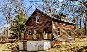
The Rev David Eato's House is in the BCALH District. It is currently owned by the Bethel African Methodist Episcopal Church. There are plans to restore it. Rev. Eato was one of the church's first pastors. He and his wife, Mary Baker, lived there until the 1930s. Mary Baker was a freed slave from the South. She moved North and became an organist at a church in Port Washington. There, she met Rev. Eato. After they married, they moved to Setauket, and he became a minister at Bethel AME in the early 1900s. Mary was the superintendent of the Sunday school until the late 1930s.
The Hawkins Homestead
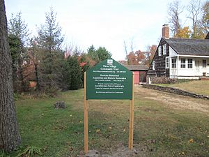
In 2013, the Three Village Community Trust bought the Hawkins Homestead. This home is also on Christian Avenue in Setauket and was added to the National Register of Historic Places in 1988.
Patriots Rock
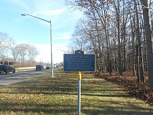
Patriots Rock is located on Main Street in East Setauket. It is part of the larger Old Setauket Historical District. There is a plaque there that remembers the spot where Colonel Webb fired his cannons during the Revolutionary War.
In Popular Culture
- Setauket is the main setting for the AMC TV show TURN. This show started in 2014 and tells the story of the Culper Spy Ring, a group of spies during the Revolutionary War.
- The play Running Scared, Running Free was performed in Stony Brook, New York, in 2005.
- The book Hidden in Plain View by Raymond Dobard, Jr. (1999) talks about quilts and the Underground Railroad. It mentions Setauket and routes through Long Island to Canada.


