Bloody River (Canada) facts for kids
Quick facts for kids Bloody River |
|
|---|---|
| Country | Canada |
| Physical characteristics | |
| River mouth | Great Bear Lake |
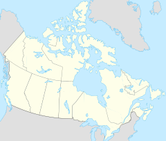
The Bloody River is a river located in the northern part of Canada. It flows through two large regions: Nunavut and the Northwest Territories. This river is part of the amazing Canadian Arctic tundra, a vast, treeless area. The Bloody River eventually flows into the Dease Arm of Great Bear Lake, which is one of the biggest lakes in the world. Its exact location where it meets the lake is around 66°56′01″N 120°34′07″W / 66.93361°N 120.56861°W.
Exploring the Bloody River
The Bloody River flows through a very unique and wild part of Canada. This area is known for its cold climate and special landscapes. Even though it's a remote place, the river and its surroundings are full of interesting natural features.
Unique Landforms
Near the Bloody River, scientists have found some cool geological features. For example, there are places where you can see a type of rock called gypsum from the Saline River area. Gypsum is a soft mineral often used to make plaster.
Scientists have also studied the landforms around the river. They noticed special shapes in the ground that were created by ancient glaciers. These shapes are sometimes called "crag-and-tail drumlins." Imagine a small hill (the "crag") with a long, gentle slope (the "tail") behind it. These were formed when huge sheets of ice moved across the land, shaping the rocks and soil. These unique landforms show how powerful glaciers were in shaping the landscape of the Canadian Arctic.
 | Jewel Prestage |
 | Ella Baker |
 | Fannie Lou Hamer |


