Bluewater Village, New Mexico facts for kids
Quick facts for kids
Bluewater Village, New Mexico
|
|
|---|---|
|
Census-designated place
|
|
| Country | United States |
| State | New Mexico |
| County | Cibola |
| Area | |
| • Total | 3.56 sq mi (9.22 km2) |
| • Land | 3.55 sq mi (9.18 km2) |
| • Water | 0.01 sq mi (0.03 km2) |
| Elevation | 6,628 ft (2,020 m) |
| Population
(2020)
|
|
| • Total | 464 |
| • Density | 130.85/sq mi (50.52/km2) |
| Time zone | UTC-7 (Mountain (MST)) |
| • Summer (DST) | UTC-6 (MDT) |
| ZIP code |
87005
|
| Area code(s) | 505 |
| GNIS feature ID | 2584059 |
Bluewater Village is a small community in Cibola County, New Mexico, United States. It's known as a census-designated place, which means it's an area identified by the United States Census Bureau for statistical purposes. In 2020, about 464 people lived there.
Contents
About Bluewater Village
Bluewater Village is located west of a larger town called Grants. The community has its own elementary school, Bluewater Elementary. It also has a post office with the ZIP code 87005.
The area where Bluewater Village now stands was once home to a Navajo community. They called the place Agua Azul, which means "Blue Water" in Spanish.
How Bluewater Village Started
The town of Bluewater was first created in 1880. It began as a stop along the A&P Railroad line. Later, in 1896, some Mormon settlers built a special earthen dam nearby. They started a new community called Mormontown.
Over time, the original railroad town faded away. Mormontown then took on the name Bluewater, becoming the community we know today.
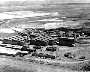
The Bluewater Mill
Near Bluewater Village, there was once a large industrial site called the Bluewater Mill. This mill was operated by a company called Anaconda Copper. It was a uranium mill, which means it processed uranium ore. The mill ran from 1954 until 1982.
After it closed, the site needed to be cleaned up. This cleanup, called "reclamation," happened in 1995. It was done under a special law designed to control radiation from uranium mills. The U.S. Department of Energy now keeps an eye on the site to make sure it stays safe.
Population Facts
The population of Bluewater Village has changed over the years.
| Historical population | |||
|---|---|---|---|
| Census | Pop. | %± | |
| 2020 | 464 | — | |
| U.S. Decennial Census | |||
See also
 In Spanish: Bluewater Village (Nuevo México) para niños
 | Victor J. Glover |
 | Yvonne Cagle |
 | Jeanette Epps |
 | Bernard A. Harris Jr. |


