Bolton, North Carolina facts for kids
Quick facts for kids
Bolton, North Carolina
|
|
|---|---|

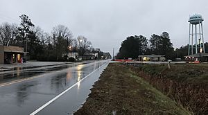
North Carolina Highway 214 (Sam Potts Highway)
|
|
| Country | United States |
| State | North Carolina |
| County | Columbus |
| Area | |
| • Total | 3.60 sq mi (9.33 km2) |
| • Land | 3.60 sq mi (9.33 km2) |
| • Water | 0.00 sq mi (0.00 km2) |
| Elevation | 59 ft (18 m) |
| Population
(2020)
|
|
| • Total | 519 |
| • Density | 144.09/sq mi (55.63/km2) |
| Time zone | UTC-5 (Eastern (EST)) |
| • Summer (DST) | UTC-4 (EDT) |
| ZIP code |
28423
|
| Area codes | 910, 472 |
| FIPS code | 37-06860 |
| GNIS feature ID | 2405300 |
Bolton is a town located in Columbus County, North Carolina, in the United States. In 2020, about 519 people lived there.
Contents
History of Bolton
Bolton was started in 1899. It was named after the Bolton Lumber Company. The town officially became an incorporated community in 1915. This means it gained its own local government.
In the early 1980s, federal agents looked into issues in Columbus County. They were checking into problems with elections. As part of this, they looked into a vote in Bolton. The vote was about allowing certain types of drinks to be sold in town. The North Carolina State Board of Elections later cancelled the results of this vote.
After this, Bolton faced some challenges. In 1990, an event involving the town's first Black mayor led to protests. These protests were called the "Bolton Movement." They focused on civil rights. Other groups also held demonstrations in the town. Later, there were concerns about how the town's money was being managed. Also, in 2002, the police chief was investigated after complaints about police actions.
Geography of Bolton
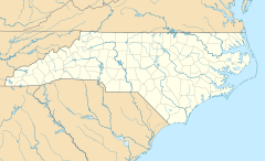
Bolton is in the eastern part of Columbus County. Major roads, U.S. Routes 74 and 76, go around the north side of the town. These roads are a four-lane highway.
If you go east on US 74/76, you will reach Wilmington in about 28 miles. If you go west, you will reach Whiteville in about 18 miles. Whiteville is the main town of Columbus County.
The United States Census Bureau says that Bolton covers an area of about 3.6 square miles (9.7 square kilometers). All of this area is land.
Population of Bolton
| Historical population | |||
|---|---|---|---|
| Census | Pop. | %± | |
| 1920 | 699 | — | |
| 1930 | 976 | 39.6% | |
| 1940 | 760 | −22.1% | |
| 1950 | 606 | −20.3% | |
| 1960 | 617 | 1.8% | |
| 1970 | 534 | −13.5% | |
| 1980 | 563 | 5.4% | |
| 1990 | 531 | −5.7% | |
| 2000 | 494 | −7.0% | |
| 2010 | 691 | 39.9% | |
| 2020 | 519 | −24.9% | |
| U.S. Decennial Census | |||
What the 2020 Census Shows
The census helps us understand the people living in a town. As of the 2020 United States census, there were 519 people living in Bolton. These people made up 254 households and 160 families.
The table below shows the different groups of people living in Bolton in 2020:
| Group | Number of People | Percentage |
|---|---|---|
| White (not Hispanic or Latino) | 124 | 23.89% |
| Black or African American (not Hispanic or Latino) | 297 | 57.23% |
| Native American | 35 | 6.74% |
| Asian | 4 | 0.77% |
| Other/Mixed (two or more races) | 31 | 5.97% |
| Hispanic or Latino | 28 | 5.39% |
See also
 In Spanish: Bolton (Carolina del Norte) para niños


