Bondsville, Massachusetts facts for kids
Bondsville is a small area located within the town of Palmer in Hampden County, which is in western Massachusetts. It used to be a special area counted separately for the census. In 2000, about 1,876 people lived there. Bondsville is part of the larger Springfield area. The village got its name from Emelius Bond. He was the first person to get the rights to use the water from the Swift River in 1846. This allowed him to start the Bond Village Manufacturing Company.
Contents
Exploring Bondsville's Past
Emelius Bond was born in 1800. He came to the area that would become Bondsville in 1830. He started a mill that used the power of the Swift River's water. In 1846, his company, the Bond Village Manufacturing Company, officially gained the legal rights to the river's water. Later, a new company called the Boston Duck Company bought the mill. They made fabrics, especially strong material for raincoats.
The Boston Duck Company closed down in 1941. Its buildings and many homes for the mill workers were sold. In October 1968, a huge fire destroyed the entire complex. It had stood along much of Main Street.
Important Buildings and Places
Overlooking Main Street is the old St. Bartholomew Roman Catholic church. It was built between 1878 and 1879. The first church service was held there on Christmas Day in 1879. The church was closed in 2009.
Trains and Transportation
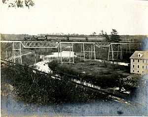
Two different railroads used to serve Bondsville. The Boston and Maine Railroad had a station on Maple Street. It was located just south of the Swift River. Another railroad, the Boston and Albany Railroad, also had stations. It had both a passenger station and a freight station. These stations were actually in the nearby town of Belchertown, Massachusetts. This train line stopped running when the Quabbin Reservoir was created. The next stop on that line, Enfield, is now under the waters of the reservoir.
Where is Bondsville?
Bondsville is located at about 42.2089 degrees north and 72.3439 degrees west.
The area of Bondsville is about 9.6 square kilometers (3.7 square miles). Most of this area is land, about 9.5 square kilometers (3.7 square miles). A small part, about 0.1 square kilometers (0.1 square miles), is water. The special postal code for Bondsville is 01009.
Who Lives in Bondsville?
In 2000, there were 1,876 people living in Bondsville. There were 734 households, which are groups of people living together. About 35% of these households had children under 18 living with them. The average household had about 2.56 people. The average age of people in Bondsville was 38 years old.
 | Claudette Colvin |
 | Myrlie Evers-Williams |
 | Alberta Odell Jones |


