Bono, Vermillion County, Indiana facts for kids
Quick facts for kids
Bono
|
|
|---|---|

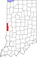
Vermillion County's location in Indiana
|
|
| Country | United States |
| State | Indiana |
| County | Vermillion |
| Township | Helt |
| Elevation | 636 ft (194 m) |
| Time zone | UTC-5 (Eastern (EST)) |
| • Summer (DST) | UTC-4 (EDT) |
| ZIP code |
47847
|
| Area code(s) | 765 |
| GNIS feature ID | 431326 |
Bono is a small place in Indiana, United States. It's called an unincorporated community. This means it's a group of homes and businesses that don't have their own local government, like a city or town does. Instead, it's part of a larger area called Helt Township in Vermillion County.
The Story of Bono
Bono was started a long time ago, in the year 1848. People say the name "Bono" means "good." It's a simple name for a quiet community.
Where is Bono?
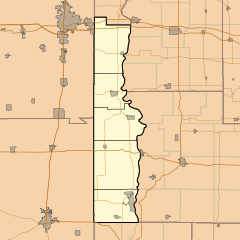
Bono is located in Vermillion County, Indiana. It's about two miles east of the state line. You can find it where Indiana State Road 71 meets County Road 850 South.
Nearby Places
A place called Bono Cemetery is located just west of the community. The land around Bono is mostly flat. It is used for farming. A small stream, which is part of Norton Creek, starts near Bono and flows southeast.
 | Bayard Rustin |
 | Jeannette Carter |
 | Jeremiah A. Brown |


