Booroondarra County facts for kids
Quick facts for kids BooroondarraNew South Wales |
|||||||||||||||
|---|---|---|---|---|---|---|---|---|---|---|---|---|---|---|---|

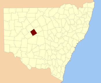
Location in New South Wales
|
|||||||||||||||
|
|||||||||||||||
Booroondarra County is one of the many special land areas in New South Wales, Australia. These areas are called cadastral divisions. They help keep track of land ownership and boundaries. Booroondarra is believed to get its name from a word used by local Aboriginal people.
Contents
What is Booroondarra County?
Booroondarra County is a way of dividing land in New South Wales. It's like a really old map system. These counties were created a long time ago to help organize land for farming, selling, and other uses. They are not the same as the local government areas you might know today.
Where is Booroondarra County Located?
Booroondarra County is found in the western part of New South Wales. It's a large area, and it shares borders with other counties. For example, to its north are Yanda and Robinson counties. To the west, you'll find Rankin County.
The Meaning Behind the Name
The name Booroondarra is thought to come from an Aboriginal word. Many places in Australia have names that come from the languages of the first people to live there. This shows the deep history and connection Indigenous Australians have to the land.
How Land is Divided: Parishes
Within Booroondarra County, the land is further divided into smaller sections called parishes. Think of parishes as smaller neighborhoods or blocks within a larger county. These smaller divisions help with very specific land records. Each parish has its own name and boundaries. Most of the parishes in Booroondarra County are part of the Cobar Shire local government area.
 | William L. Dawson |
 | W. E. B. Du Bois |
 | Harry Belafonte |

