Bouchard Lake facts for kids
Quick facts for kids Bouchard Lake |
|
|---|---|

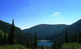
Bouchard Lake near Bald Hill
|
|
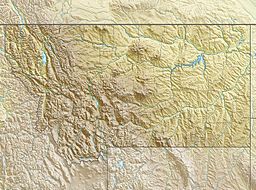
| Location | Mineral County, Montana, United States |
| Coordinates | 47°13′14″N 115°00′02″W / 47.2205°N 115.0005°W |
| Type | Natural/Fresh Water Lake |
| Primary outflows | outlet northwards to Clark Fork River |
| Basin countries | United States |
| Max. length | 2,460 ft (750 m) |
| Max. width | 315 ft (96 m) |
| Surface area | 16.2 acres (6.6 ha) |
| Surface elevation | 2,943 ft (897 m) |
Bouchard Lake is a cool, L-shaped lake located in Mineral County, Montana, in the United States. It covers about 16 acres, which is roughly the size of 12 football fields! You can find this lake about five miles northwest of Superior, Montana. It sits in the beautiful valley of the Clark Fork River.
What's Under the Lake? (Geology)
Bouchard Lake is so special that a type of rock formation is named after it! This rock layer is called the Bouchard Formation. It's made mostly of two kinds of rocks: micaceous quartzite and quartzose argillite. These rocks are found layered together near the lake. Geologists study these formations to learn about Earth's history.
Black History Month on Kiddle
Contemporary African-American Artists:
 | Janet Taylor Pickett |
 | Synthia Saint James |
 | Howardena Pindell |
 | Faith Ringgold |

All content from Kiddle encyclopedia articles (including the article images and facts) can be freely used under Attribution-ShareAlike license, unless stated otherwise. Cite this article:
Bouchard Lake Facts for Kids. Kiddle Encyclopedia.

