Bourbon River facts for kids
Quick facts for kids Bourbon River |
|
|---|---|

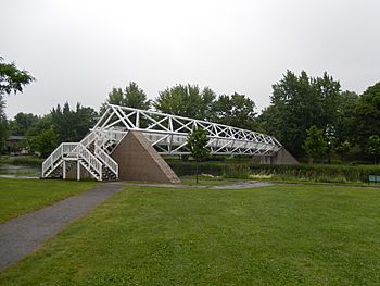
Armand-Vaillancourt footbridge on the Bourbon river in Plessisville
|
|
| Native name | Rivière Bourbon |
| Country | Canada |
| Province | Quebec |
| Region | Centre-du-Québec |
| MRC | L'Érable Regional County Municipality |
| Physical characteristics | |
| Main source | Forest streams Sainte-Sophie-d'Halifax 398 m (1,306 ft) 46°09′03″N 71°40′00″W / 46.1507901°N 71.666691°W |
| River mouth | Bécancour River Princeville 100 m (330 ft) 46°16′47″N 71°55′11″W / 46.27972°N 71.91972°W |
| Length | 37.9 km (23.5 mi) |
| Basin features | |
| Progression | Bécancour River, St. Lawrence River |
| Tributaries |
|
The Bourbon River (in French: rivière Bourbon) is a river in Quebec, Canada. It flows into the Bécancour River. The Bourbon River passes through several towns. These include Sainte-Sophie-d'Halifax, Plessisville, Quebec (parish), Plessisville (town), Notre-Dame-de-Lourdes, and Princeville. It is located in the L'Érable Regional County Municipality (MRC). This area is part of the Centre-du-Quebec region.
Contents
Exploring the Bourbon River's Path
The Bourbon River starts in a forest area. This area is south of Plessisville. The river then flows for about 37.9 kilometers (23.5 miles).
Where Does the River Flow?
The Bourbon River flows through different areas:
- It starts by flowing west for 2.3 km (1.4 mi) in Sainte-Sophie-d'Halifax. It reaches the village bridge there.
- Next, it goes north-west for 3.9 km (2.4 mi). It crosses the village and reaches the border of Plessisville (parish).
- Then, it flows north for 2.3 km (1.4 mi) to a road.
- It continues north-west for 1.7 km (1.1 mi). Here, it meets the "Ruisseau de la Savane."
- The river flows north for 3.2 km (2.0 mi). It reaches a bridge south of Plessisville.
- It travels north-west for 2.3 km (1.4 mi) through Plessisville. It passes under seven bridges in the town.
- The river then flows north-west for 8.0 km (5.0 mi). It reaches the border of Notre-Dame-de-Lourdes.
- It winds westward for 9.4 km (5.8 mi) through Notre-Dame-de-Lourdes. It passes south of a large marshy area.
- Finally, it flows westward for 4.8 km (3.0 mi) through Princeville. It winds between two marsh areas before reaching its end.
Where the River Ends
The Bourbon River empties into the south-east side of the Bécancour River. This meeting point is upstream from the Jacques brook. It is also downstream from the Noire River. This spot is north of the village of Plessisville.
The Story Behind the Name: Bourbon River
The name of the Bourbon River has an interesting history. In 1815, a map by Joseph Bouchette called it "Rivière Blanche" (White River). People still used this name for a long time.
How the Name Changed
In 1924, the "Commission de géographie du Québec" officially changed the name to "Bourbon River." This was suggested by the "Geographic Commission of Canada." Even today, some local people still call it "Rivière Blanche."
Possible Meanings of "Bourbon"
There are a few ideas about where the name "Bourbon" comes from:
- One idea connects it to a family member who came to New France in the 1600s.
- Another idea links it to the royal family of Bourbon in France.
- A third idea suggests the name comes from an old word. This word, "Borvo" or "Bormo," meant a god of hot springs. It might also relate to words like "mud" or "mire."
- A fourth idea suggests the name refers to a member of the French royal family who came to Canada in 1795. This person lived under a different name and worked as a goldsmith.
The name "Bourbon River" was officially recognized on December 5, 1968. This was done by the Commission de toponymie du Québec.
 | Emma Amos |
 | Edward Mitchell Bannister |
 | Larry D. Alexander |
 | Ernie Barnes |

