Bowie, Arizona facts for kids
Quick facts for kids
Bowie, Arizona
|
|
|---|---|
|
Census designated place
|
|

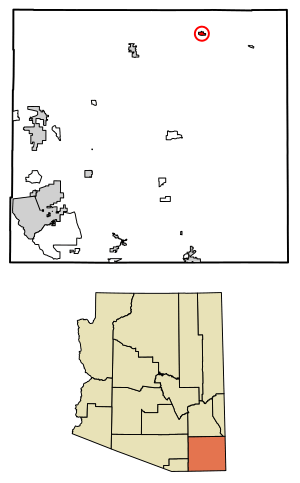
Location of Bowie in Cochise County, Arizona.
|
|
| Country | United States |
| State | Arizona |
| County | Cochise |
| Area | |
| • Total | 1.71 sq mi (4.42 km2) |
| • Land | 1.71 sq mi (4.42 km2) |
| • Water | 0.00 sq mi (0.00 km2) |
| Elevation | 3,763 ft (1,147 m) |
| Population
(2020)
|
|
| • Total | 406 |
| • Density | 237.98/sq mi (91.89/km2) |
| Time zone | UTC-7 (Mountain (MST)) |
| • Summer (DST) | UTC-7 (MST) |
| ZIP codes |
85605
|
| Area code(s) | 520 |
| FIPS code | 04-07380 |
| GNIS feature ID | 2582739 |
Bowie is a small community in Cochise County, Arizona, United States. It's known as an unincorporated community, which means it doesn't have its own local government like a city or town. It's also a census-designated place (CDP), which is an area the U.S. Census Bureau uses for gathering population data. In 2020, about 406 people lived in Bowie.
Contents
History of Bowie
Early Days and the Railroad
Bowie got its start thanks to the Southern Pacific Transportation Company. This company built a railway line through eastern Arizona in 1880. Bowie was one of the stops along this important new route.
In March 1881, this railway connected with other lines in Deming, New Mexico. This connection created the second transcontinental rail route across the entire United States. This was a huge deal for travel and trade!
How Bowie Got Its Name
The community of Bowie is named after a nearby old military post called Fort Bowie. The fort played an important role in the history of the area.
People of Bowie
Population Changes Over Time
Bowie has seen its population change over the years. In 1910, when it was first counted as the "Bowie Precinct," there were 546 people. The population grew to 885 by 1920, then dropped to 609 in 1930. By 1960, it was 650. In recent times, the population was 449 in 2010 and 406 in 2020.
Where is Bowie Located?
Finding Bowie on the Map
Bowie is located in eastern Arizona. It's very close to the border with New Mexico. You can find it right along Interstate 10, a major highway.
The community sits in the western part of the San Simon Valley. It's also near the northeast foothills of the Dos Cabezas Mountains. If you travel west from Bowie on Interstate 10, you'll reach Willcox, Arizona. If you head east, you'll find San Simon, Arizona, and then Lordsburg, New Mexico.
Important Information About Bowie
ZIP Code Details
Bowie uses the ZIP Code 85605. In 2010, the area covered by this ZIP Code had a population of 449 people, which was the same as the population of Bowie itself at that time.
Bowie's Climate
Bowie has a climate that is a mix of semi-arid and desert. This means it gets very hot in the summer, especially with the monsoon rains that happen then. Winters are usually mild and dry, but nights can be cold.
On average, Bowie experiences about 27 days each year where the temperature reaches 100°F (38°C) or higher. There are also about 119 days where it's 90°F (32°C) or hotter. In winter, temperatures drop below freezing on about 64 nights. However, it's so dry that temperatures usually get above 50°F (10°C) on most winter days. Snowfall is rare, with an average of only 2.6 inches (6.6 cm) per year. Many winters don't see any measurable snow at all.
Bowie in Movies
John Rambo's Hometown
Bowie, Arizona, became famous in movies because it's the hometown of the action hero John Rambo. This was first mentioned in the movie Rambo: First Blood Part II and then again in Rambo III.
In the 2008 movie Rambo, you could actually see Bowie on screen for the first time. However, the scenes were filmed in Southern California, not in Arizona. The 2019 movie Rambo: Last Blood was set entirely in Bowie and Mexico, but again, the filming didn't happen in Arizona.
See also
 In Spanish: Bowie (Arizona) para niños


