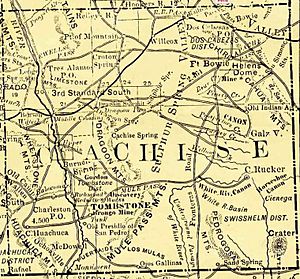
Cochise County, Arizona facts for kids
Quick facts for kids
Cochise County
|
|||
|---|---|---|---|
|
County
|
|||
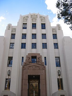
The art deco county courthouse in Bisbee
|
|||
|
|||
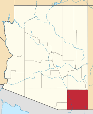
Location within the U.S. state of Arizona
|
|||
 Arizona's location within the U.S. |
|||
| Country | |||
| State | |||
| Founded | February 1, 1881 | ||
| Named for | Cochise | ||
| Seat | Bisbee | ||
| Largest city | Sierra Vista | ||
| Area | |||
| • Total | 6,219 sq mi (16,110 km2) | ||
| • Land | 6,166 sq mi (15,970 km2) | ||
| • Water | 53 sq mi (140 km2) 0.9%% | ||
| Population
(2020)
|
|||
| • Total | 125,447 | ||
| • Estimate
(2023)
|
124,640 |
||
| • Density | 20.1716/sq mi (7.7883/km2) | ||
| Time zone | UTC−7 (Mountain) | ||
| Congressional districts | 6th, 7th | ||
Cochise County is a county located in the southeastern part of Arizona, a state in the United States. It was named after Cochise, a famous leader of the Chiricahua Apache people. He was an important figure during the Apache Wars.
In 2020, about 125,447 people lived in Cochise County. The main town where the county government is located is Bisbee. The biggest city in the county is Sierra Vista.
Cochise County is part of the Sierra Vista-Douglas area. It also shares borders with New Mexico and the Mexican state of Sonora.
Contents
History of Cochise County
In the early 1500s, Spanish explorers like Álvar Núñez Cabeza de Vaca traveled through this area. Their stories led to the legend of the "Seven Cities of Gold." Later, in 1539, another explorer named Francisco Vásquez de Coronado followed their route.
Native American groups, like the Sobaipuri people, lived here. They faced challenges from Chiricahua Apache groups moving into the area. In 1775, a Spanish fort called Presidio Santa Cruz de Terrenate was built. It was meant to protect both Native Americans and Spanish settlers.
Cochise County was officially created on February 1, 1881. It was formed from the eastern part of Pima County. The county was named after the Apache chief, Cochise.
The first county seat was Tombstone. This town is famous for the gunfight at the O.K. Corral. Later, in 1929, the county seat moved to Bisbee. Famous sheriffs in the county's early days included Johnny Behan and John Horton Slaughter.
Cochise County has also been featured in movies and TV shows. The Sheriff of Cochise was a TV series filmed here from 1956 to 1958. The movie Broken Arrow was also set in Cochise County.
In the late 1950s, a small community called Miracle Valley became home to several religious organizations.
Geography of Cochise County
Cochise County covers a large area of about 6,219 square miles. Most of this is land, with a small amount of water. To give you an idea of its size, Cochise County is almost as big as the states of Rhode Island and Connecticut put together!
Neighboring Areas
Cochise County shares borders with other counties and areas:
- Santa Cruz County – to the south and west
- Pima County – to the west
- Graham County – to the north
- Greenlee County – to the north
- Hidalgo County, New Mexico – to the east
- Agua Prieta, Sonora, Mexico – to the south
- Cananea, Sonora, Mexico – to the south
- Naco, Sonora, Mexico – to the south
- Santa Cruz, Sonora, Mexico – to the south
Special Protected Areas
Cochise County is home to many beautiful natural and historical sites:
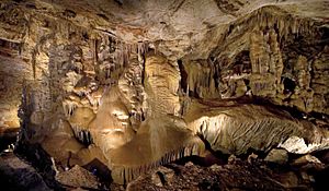
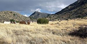
- Chiricahua National Monument
- Coronado National Forest (part of it)
- Coronado National Memorial
- Fort Bowie National Historic Site
- Kartchner Caverns State Park
- Leslie Canyon National Wildlife Refuge
- San Pedro Riparian National Conservation Area
People of Cochise County
The population of Cochise County has changed over the years. In 1890, there were about 6,938 people. By 2020, the population grew to 125,447 people.
In 2010, there were 131,346 people living in the county. The population density was about 21 people per square mile. Most people (78.5%) identified as white. Other groups included black or African American (4.2%), Asian (1.9%), and American Indian (1.2%). About 32.4% of the population was of Hispanic or Latino origin.
Many people in Cochise County have Mexican, German, Irish, or English backgrounds.
Getting Around Cochise County
Main Roads
Several important highways run through Cochise County:
 Interstate 10
 Historic U.S. Route 80
 U.S. Route 191
 State Route 80
 State Route 82
 State Route 83
 State Route 90
 State Route 92
 State Route 186
Airports
Cochise County has a few airports. The Bisbee Municipal Airport is owned by the city of Bisbee. The Sierra Vista Municipal Airport is shared with Libby Army Airfield, which is part of Fort Huachuca. These airports are mostly used for military and private planes.
If you want to catch a commercial flight, the closest airport is in Tucson, about 70 miles from Sierra Vista.
Communities in Cochise County
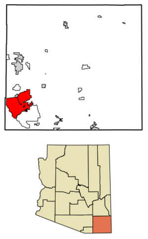
Cities
Towns
Census-designated places
These are areas that are like towns but are not officially incorporated as cities or towns.
- Bowie
- Dragoon
- Elfrida
- McNeal
- Mescal
- Miracle Valley
- Naco
- Palominas
- Pirtleville
- Sierra Vista Southeast
- St. David
- San Simon
- Sunizona
- Sunsites
- Whetstone
Other Places
These are smaller communities or areas within the county.
- Amber
- Babocomari
- Charleston
- Cochise
- Cross Rail Ranch
- Dos Cabezas
- Double Adobe
- El Dorado
- Hereford
- Hookers Hot Springs
- Kansas Settlement
- Leslie Canyon National Wildlife refuge
- Nicksville
- Paul Spur
- Pomerene
- Portal
- Paradise
- Rucker
- Stewart District
- Sunnyside
- Sunsites
- Tintown
Military Sites
- Fort Huachuca
- Willcox Playa (a proving ground for testing)
Ghost Towns
These are towns that were once active but are now mostly deserted.
- Black Diamond
- Cascabel
- Charleston
- Cochise
- Contention City
- Courtland
- Fairbank
- Galeyville
- Gleeson
- Hilltop
- Johnson
- Millville
- Paradise
- Pearce
- Tres Alamos
County Population Ranking
This table shows the largest communities in Cochise County based on the 2010 census.
| Rank | City/Town/etc. | Population (2010 Census) | Type | Founded |
|---|---|---|---|---|
| 1 | Sierra Vista | 43,888 | City | 1956 |
| 2 | Douglas | 17,378 | City | 1905 |
| 3 | Sierra Vista Southeast | 14,797 | CDP | |
| 4 | † Bisbee | 5,575 | City | 1902 |
| 5 | Benson | 5,105 | City | 1880 (founded) |
| 6 | Willcox | 3,757 | City | 1915 |
| 7 | Whetstone | 2,617 | CDP | |
| 8 | Huachuca City | 1,853 | Town | 1958 |
| 9 | Mescal | 1,812 | CDP | |
| 10 | Pirtleville | 1,744 | CDP | |
| 11 | St. David | 1,699 | CDP | |
| 12 | Tombstone | 1,380 | City | 1881 |
| 13 | Naco | 1,046 | CDP | |
| 14 | Miracle Valley | 644 | CDP | |
| 15 | Elfrida | 459 | CDP | |
| 16 | Bowie | 449 | CDP | |
| 17 | Sunizona | 281 | CDP | |
| 18 | McNeal | 238 | CDP | |
| 19 | Palominas | 212 | CDP | |
| 20 | Dragoon | 209 | CDP | |
| 21 | San Simon | 165 | CDP | |
| 22 | Sunsites | 40 | CDP |
Education in Cochise County
Cochise County has many school districts that help students learn and grow.
Unified School Districts
These districts offer education from elementary to high school.
- Benson Unified School District
- Bisbee Unified District (Bisbee High School)
- Bowie Unified District
- Douglas Unified District
- Fort Huachuca Accommodation District
- San Simon Unified District
- St. David Unified District
- Sierra Vista Unified District
- Tombstone Unified District
- Willcox Unified District
Secondary School Districts
- Valley Union High School District
Elementary School Districts
These districts focus on younger students.
- Apache Elementary District
- Ash Creek Elementary District
- Cochise Elementary District
- Double Adobe Elementary District
- Elfrida Elementary District
- McNeal Elementary District
- Naco Elementary District
- Palominas Elementary District
- Pearce Elementary District
- Pomerene Elementary District
- Rucker Elementary District
The Rucker Elementary School district is interesting because it doesn't operate its own schools. Instead, it sends its elementary students to the Elfrida district. This arrangement helps residents pay less in taxes.
See also
 In Spanish: Condado de Cochise para niños
 | Isaac Myers |
 | D. Hamilton Jackson |
 | A. Philip Randolph |


