McNeal, Arizona facts for kids
Quick facts for kids
McNeal, Arizona
|
|
|---|---|
 |
|

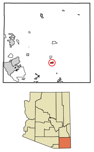
Location of McNeal in Cochise County, Arizona.
|
|
| Country | United States |
| State | Arizona |
| County | Cochise |
| Area | |
| • Total | 3.75 sq mi (9.71 km2) |
| • Land | 3.75 sq mi (9.71 km2) |
| • Water | 0.00 sq mi (0.00 km2) |
| Elevation | 4,164 ft (1,269 m) |
| Population
(2020)
|
|
| • Total | 182 |
| • Density | 48.57/sq mi (18.75/km2) |
| Time zone | UTC-7 (Mountain (MST)) |
| ZIP code |
85617
|
| Area code(s) | 520 |
| GNIS feature ID | 2582820 |
McNeal is a small community in Cochise County, Arizona, United States. It is known as an unincorporated community, which means it doesn't have its own local government like a city or town. It is also a census-designated place, which is a special area the government uses to collect population data.
As of 2020, about 182 people live in McNeal. The community is located along U.S. Route 191. It is about 21 miles (34 km) northwest of Douglas. McNeal uses the ZIP code 85617 for its mail.
Where is McNeal Located?
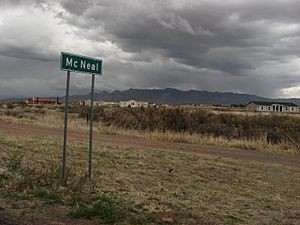
McNeal is found in the southeastern part of Arizona. It sits within Cochise County. This area is known for its wide-open spaces and desert landscapes. The community is not far from the border with Mexico.
How Many People Live Here?
The population of McNeal is quite small. In 2020, the census counted 182 residents. This number can change over time. The population density is about 48 people per square mile. This means there is a lot of space for everyone.
What is the Weather Like?
McNeal has a type of weather called a semi-arid climate. This means it is generally dry. It gets more rain than a desert, but not enough to be considered a humid place. The summers can be hot, and winters are usually mild. This climate is often seen in areas with open grasslands and some scattered trees.
See also
In Spanish: McNeal (Arizona) para niños
 | Laphonza Butler |
 | Daisy Bates |
 | Elizabeth Piper Ensley |


