Apache Pass facts for kids
Quick facts for kids Apache Pass |
|
|---|---|

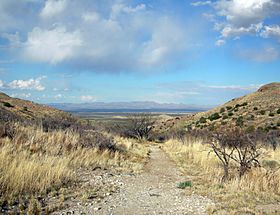
Apache Pass viewed from Fort Bowie, facing north.
|
|
| Elevation | 5,110 ft (1,558 m) |
| Traversed by | Apache Pass Road |
| Location | Cochise County, Arizona, United States |
| Coordinates | 32°09′06″N 109°28′54″W / 32.15167°N 109.48167°W |
Apache Pass, also known as Puerto del Dado (which means "Pass of the Die" in Spanish), is a famous mountain pass in Arizona, United States. It sits between the Dos Cabezas Mountains and Chiricahua Mountains. The pass is about 5,110 feet (1,558 meters) high. It is located about 20 miles (32 km) east of Willcox, Arizona, in Cochise County.
Contents
Apache Spring: A Vital Water Stop
A natural spring called Apache Spring flows from a crack in the rocks here. This spring was very important because it was the only reliable water source for many miles. Early travelers and Native American people depended on it.
For the local Apache people, especially the Chiricahua Apache, the spring was a meeting place. Many trails led to this spot. The great Apache leader Cochise and his followers often camped here in winter and spring. Hundreds of Chiricahuas sometimes lived nearby. The pass was cooler than the desert, and the area had plenty of animals for hunting and wood for fires.
Puerto del Dado: A Risky Journey
When Spanish and Mexican settlers came to the area, the spring became a place of conflict with the Apache tribes. This is why it was named Puerto del Dado, meaning "Pass of the Die." It was like a game of chance to cross the pass, full of risks.
In the 1830s, some American fur trappers may have used Apache Pass. Later, in 1846, the Mormon Battalion chose a longer, safer route around it. However, during the California Gold Rush, a group of "Forty-Niners" led by John Coffee Hays found a shorter way. This new route, called the Tucson Cutoff, went right through Apache Pass. It became part of the Southern Emigrant Trail, a major path for wagons and stagecoaches traveling east to west.
Apache Pass Station: A Stagecoach Stop
In 1858, the Butterfield Overland Mail Company started stagecoach service across the country. They built a stone station at Apache Pass. Here, they could rest their horses and get water from the spring. This station, and another one nearby, were built strongly because of the danger from local Apache groups.
Apache Pass Station was located between other stations. It was 19 miles (31 km) west of San Simon Station and 15 miles (24 km) from Ewell Station. This made the journey shorter and provided more water stops. It is thought that Cochise's group sometimes helped the stagecoach travelers by providing firewood.
Bascom Affair: The Start of Conflict
In February 1861, an event happened here that started a long war. A group of U.S. soldiers, led by Lt. George Nicholas Bascom, camped near the spring. They wanted to talk with Cochise about a kidnapped child. When Cochise met with Bascom, the lieutenant tried to arrest him and other Apaches.
This led to a tense stand-off that lasted several days. Sadly, people on both sides were killed. This misunderstanding made Cochise very angry. It started an eleven-year war between Cochise and the Americans, including the Battle of Apache Pass in 1862. The war finally ended with a peace treaty in 1872.
Fort Bowie: Protecting the Pass
After the Battle of Apache Pass in July 1862, the U.S. military built Fort Bowie. This fort was made to protect the pass and the important spring. First, a simple fort was built, then a stronger one was made higher up. Fort Bowie became the main base for fighting the Chiricahua Apaches.
When Cochise and General Oliver Otis Howard made peace, a large reservation was created for the Chiricahua Apaches. It was centered around Apache Pass, near Fort Bowie. However, after Cochise died in 1874, the Chiricahuas were moved to the San Carlos Apache Indian Reservation.
Apache Pass remained important until Geronimo and his group surrendered in 1886. In the early 1890s, after the Apache Wars ended, Fort Bowie was closed. Travelers then used the railroad, which was built a few miles north. Today, only a few old walls remain at Apache Pass, reminding us of its past.
Apache Pass Today: A Historic Site
Today, Apache Pass is part of Fort Bowie National Historic Site. The National Park Service manages and protects this area. Visitors can hike trails and drive along Apache Pass Road. They can see the remains of the Butterfield stage station and the old fort ruins. The path of the stagecoach trail can still be seen. Apache Spring still flows, though it is smaller now. The quiet of the pass today is very different from the busy times of over 125 years ago.
See also
 In Spanish: Apache Pass para niños
 | Chris Smalls |
 | Fred Hampton |
 | Ralph Abernathy |


