
San Carlos Apache Indian Reservation facts for kids
| Tsékʼáádn (Western Apache) | |
|---|---|

Flag of the San Carlos Apache Nation
|
|

Location of San Carlos Apache Indian Reservation
|
|
| Total population | |
| 16,250 | |
| Regions with significant populations | |
| United States (Arizona) | |
| Languages | |
| Western Apache, Spanish, English | |
| Religion | |
| Traditional Tribal Religions, Christianity (especially Lutheranism) | |
| Related ethnic groups | |
| Apache, Navajo(Diné) |
The San Carlos Apache Indian Reservation (in the Western Apache it's called Tsékʼáádn) is a special area of land in southeastern Arizona, United States. It was created in 1872 for the Chiricahua Apache tribe and other Apache and Yavapai groups.
At first, it was a tough place to live. But today, the San Carlos Apache people run successful businesses. They have a Chamber of Commerce, two casinos (Apache Gold and Apache Sky), a program to save their language, a Culture Center, and even a Tribal College.
Contents
A Look Back: History of the San Carlos Apache
On December 14, 1872, President U.S. Grant officially created the San Carlos Apache Reservation. The government asked different religious groups to help manage these new reservations. The Dutch Reformed Church was put in charge of the San Carlos Apache Reservation.
They chose a man named John Clum to be the Indian Agent. An Indian Agent was a government official who managed relations with Native American tribes. Clum arrived at the reservation on August 4, 1874.
The U.S. Army and government leaders often had trouble understanding Native American cultures. They sometimes tried to make all tribes live the same way. This caused problems because different tribes had their own customs and friendships. The Apache people were supposed to get food and housing from the government. But they often didn't receive enough help and faced hardships.

John Clum worked hard to earn the trust of the Apache people. He became good friends with Eskiminzin, an Aravaipa Apache chief. Clum convinced many White Mountain Apache people to move to San Carlos. The Apache people trusted him and even gave up their weapons.
They also started a tribal court to handle small problems. They formed a Tribal Police force under Clum's leadership. This was an early step toward the Apache people managing their own affairs. Clum soon brought about 4,200 Apache and Yavapai people to the reservation.
In 1877, Clum and 100 of his Apache Police captured Geronimo. Geronimo was a famous Apache leader. The U.S. Army had tried hard to catch Geronimo, so Clum's success was a big surprise. But some government officials and Army leaders didn't like Clum's methods. They made his job very difficult.
Clum eventually resigned from his position. After he left, the new leaders of the reservation released Geronimo. This led to more than 15 years of conflict in the American Southwest.

Bringing Tribes Together
In March 1875, the government closed another reservation, the Camp Verde Reservation. The Yavapai people living there were forced to walk about 180 miles (290 km) to the San Carlos Apache Indian Reservation. Sadly, over 100 Yavapai people died during this difficult journey in the winter.
.jpg)
After 1886, the San Carlos Reservation became home to many different Apache-speaking groups. These included the Pinal Coyotero, Aravaipa, Pinaleño, Apache Peaks, and San Carlos proper bands. Other groups like the Cibecue Apache, Southern Tonto Apache, and some Chiricahua and White Mountain Apache also moved there.
By the early 1900s, some Yavapai people started leaving San Carlos. They wanted to return to their original Camp Verde Reservation.
After the Indian Reorganization Act of 1934, the various Apache groups on the reservation formed a government. They became officially recognized as the San Carlos Nation. An anthropologist (someone who studies human societies and cultures) named Greenville Goodwin helped them decide what kind of government they wanted. This new law helped them gain more control over their own lands and lives.
Growing and Developing Today
In 1999, the San Carlos Apache people started the Apache Nation Chamber of Commerce (ANCC). Its goal is to help businesses grow and succeed for everyone in the community. The ANCC encourages people and companies to work with Arizona's tribal governments.
The San Carlos Apache Tribe Wellness Center opened in 2003. It's run by the tribe and helps people with mental health and wellness. The center has special round rooms that look like traditional Apache wickiups (homes).
The San Carlos Apache Tribe's Language Preservation Program started in 2011. It works to save and develop the Apache language for the tribe's 14,000 members.
In 2014, tribal Chairman Terry Rambler announced the creation of the San Carlos Tribal College. The tribe is working with Arizona State University to create courses for a two-year Associate degree.
Population and Community Life
As of August 2014, there were 15,393 members of the San Carlos Apache tribe. In 2018, about 9,945 to 10,945 people lived on the reservation.
The average household income on the San Carlos Reservation is about $27,542 per year. Some people on the reservation face economic challenges, and many are looking for jobs.
Geography and Nature
.jpg)
The San Carlos Apache Indian Reservation covers a huge area of 1.8 million acres. It's located in parts of Graham, Gila, and Pinal Counties in Arizona. The main communities on the reservation are Bylas, Gilson Wash, Peridot, and 7mile.
San Carlos Lake was created by the Coolidge Dam. It is the second-largest body of water in Arizona. The reservation is the tenth-largest Indian reservation by land area. It has many different types of land, from deserts to high alpine meadows and Ponderosa Pine forests. The Fort Apache Indian Reservation is located directly to the north.
Getting Around: Transportation
U.S. Route 70 runs through the reservation from north to south.
San Carlos Apache Nnee Bich'o Nii Transit provides bus services within the reservation. It also connects to nearby towns like Globe and Safford. Greyhound Lines also stops in Bylas and Peridot on its route between Phoenix and El Paso.
Fun Places to Visit: Attractions
- The San Carlos Apache Culture Center shares the amazing stories and history of the Apache people.
- The Apache Gold Casino is owned and run by the San Carlos Apache Nation. It offers games, places to eat, and lodging.
- The San Carlos Recreation and Wildlife Department lets visitors enjoy hunting, fishing, boating, camping, and birdwatching. The reservation has beautiful scenery. You need tribal permits to do these activities, which you can get from local stores.
Notable Tribal Members
- Douglas Miles, an artist and the founder of Apache Skateboards.
- Mary Kim Titla, a former award-winning reporter and anchor for NBC-TV in Phoenix.
- Craig Dan Goseyun, a talented sculptor.
- Chesley Goseyun Wilson, an actor and a maker of the Apache violin.
- Lynnette Haozous, an artist.
Images for kids
-
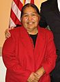
Kathy Kitcheyan, former chairwoman of the San Carlos Apache
-
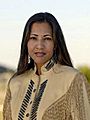
Mary Kim Titla, award-winning reporter/anchor


