
Braefield, New South Wales facts for kids
Quick facts for kids BraefieldNew South Wales |
|||||||||||||||
|---|---|---|---|---|---|---|---|---|---|---|---|---|---|---|---|

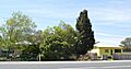
Houses fronting the Kamilaroi Highway at Braefield
|
|||||||||||||||

Braefield
Location in New South Wales
|
|||||||||||||||
| Population | 62 (2016 census) | ||||||||||||||
| Postcode(s) | 2339 | ||||||||||||||
| Elevation | 388 m (1,273 ft) | ||||||||||||||
| Location | |||||||||||||||
| LGA(s) | Liverpool Plains Shire | ||||||||||||||
| Region | North West Slopes | ||||||||||||||
| County | Buckland | ||||||||||||||
| Parish | Quirindi | ||||||||||||||
| State electorate(s) | Upper Hunter | ||||||||||||||
| Federal Division(s) | New England | ||||||||||||||
|
|||||||||||||||
Braefield is a small place, also known as a locality, located in the northern part of New South Wales, Australia. It sits right on the Main North railway line and the Kamilaroi Highway. This makes it easy to reach by both train and road.
Discovering Braefield
Braefield is a very small community. In 2016, only 62 people lived there. It is part of the Liverpool Plains Shire, which is a local government area. The area is known for its beautiful countryside.
Where is Braefield?
Braefield is found in the North West Slopes region of New South Wales. It is about 343 kilometers (213 miles) northwest of Sydney, Australia's largest city. The town of Quirindi is very close, just 7 kilometers (4 miles) to the south. Newcastle, another major city, is about 220 kilometers (137 miles) to the northwest. Braefield is located 388 meters (1,273 feet) above sea level.
A Look at Braefield's Past
Braefield has a connection to Australia's railway history. A railway station opened here way back in 1878. This would have been an important stop for trains carrying people and goods. Today, however, there is no longer any trace of the old station. It has disappeared over time.
Images for kids
-
Houses fronting the Kamilaroi Highway at Braefield
