Brantleyville, Alabama facts for kids
Quick facts for kids
Brantleyville, Alabama
|
|
|---|---|

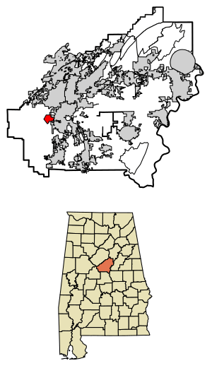
Location of Brantleyville in Shelby County, Alabama.
|
|
| Country | United States |
| State | Alabama |
| County | Shelby |
| Area | |
| • Total | 2.21 sq mi (5.71 km2) |
| • Land | 2.20 sq mi (5.69 km2) |
| • Water | 0.01 sq mi (0.03 km2) |
| Elevation | 554 ft (169 m) |
| Population
(2020)
|
|
| • Total | 931 |
| • Density | 423.95/sq mi (163.68/km2) |
| Time zone | UTC-6 (Central (CST)) |
| • Summer (DST) | UTC-5 (CDT) |
| Area code(s) | 205, 659 |
| GNIS feature ID | 121304 |
Brantleyville is a small community located in Shelby County, Alabama, in the United States. It is known as a census-designated place (CDP) and an unincorporated community. This means it's a place where people live that is recognized by the government for counting purposes, but it doesn't have its own local city government.
As of the 2020 census, about 931 people lived in Brantleyville.
Contents
What is Brantleyville?
Brantleyville is a unique type of community. It's not officially a city or town with its own mayor and city council. Instead, it's part of the larger Shelby County.
Census-Designated Place (CDP)
A census-designated place, or CDP, is an area that the United States Census Bureau identifies for statistical purposes. Think of it like a special boundary drawn just for counting people. This helps gather important information about where people live, even if the area isn't a formal city.
Unincorporated Community
An unincorporated community is a place that doesn't have its own local government. This means that services like police, fire, and road maintenance are usually provided by the county government, which in this case is Shelby County. Many small communities across the U.S. are unincorporated.
Where is Brantleyville?
Brantleyville is located in the central part of Alabama. It's found within Shelby County, which is known for its beautiful landscapes and growing communities.
Geography and Area
The community covers a total area of about 2.21 square miles (5.71 square kilometers). Most of this area is land, with only a tiny bit of water. The elevation of Brantleyville is around 554 feet (169 meters) above sea level.
How Many People Live Here?
The number of people living in Brantleyville is counted every ten years by the U.S. government. This count is called the United States Census.
Population Changes Over Time
The population of Brantleyville has changed a bit over the years. In 2010, there were 884 people. By 2020, the population had grown to 931 people. This information helps us understand how communities are growing or changing.
| Historical population | |||
|---|---|---|---|
| Census | Pop. | %± | |
| 2020 | 931 | — | |
| U.S. Decennial Census | |||
See also
 In Spanish: Brantleyville para niños
 | John T. Biggers |
 | Thomas Blackshear |
 | Mark Bradford |
 | Beverly Buchanan |


