Brewer Peak facts for kids
Quick facts for kids Brewer Peak |
|
|---|---|
| Highest point | |
| Elevation | 2,110 m (6,920 ft) |
| Geography | |
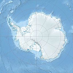
| Location | Pennell Coast, Victoria Land, Antarctica |
| Parent range | Admiralty Mountains |
Brewer Peak (71°34′S 168°28′E / 71.567°S 168.467°E) is a tall mountain peak in Antarctica. It stands 2,110 meters (about 6,922 feet) high. This peak is part of a large group of mountains called the Admiralty Mountains. It is located along the western side of the Pitkevitch Glacier.
Contents
Discovering Brewer Peak
This section explains how Brewer Peak was first found and mapped. It also tells us who it was named after.
Mapping a New Place
Scientists first mapped Brewer Peak between 1960 and 1963. The United States Geological Survey did this important work. They used special surveys and air photos taken by the United States Navy. These photos helped them create detailed maps of the area.
Who Was Thomas J. Brewer?
Brewer Peak was named after a person named Thomas J. Brewer. He was a Commissaryman in the United States Navy. A Commissaryman helps manage food and supplies. Thomas J. Brewer worked at McMurdo Station in Antarctica in 1967. McMurdo Station is a large research base on Ross Island. The Advisory Committee on Antarctic Names decided to name the peak after him. This was a way to honor his service in Antarctica.
Where Exactly is Brewer Peak?
Brewer Peak is located in a region of Antarctica called Victoria Land. More specifically, it is on the Pennell Coast. The Pennell Coast is a part of Antarctica's coastline. It stretches between two other important points: Cape Williams and Cape Adare.


