Briggs Glacier facts for kids
Quick facts for kids Briggs Glacier |
|
|---|---|
| Location | South Georgia |
| Coordinates | 54°10′S 37°8′W / 54.167°S 37.133°W |
| Thickness | unknown |
| Terminus | Murray Snowfield |
| Status | unknown |
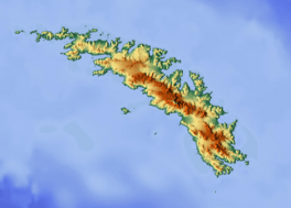
Briggs Glacier (54°10′S 37°8′W / 54.167°S 37.133°W) is a large river of ice located in the middle of South Georgia. It flows towards the northwest, ending in an area called Murray Snowfield. This glacier is found between two important landmarks: Mount Worsley and The Trident.
The Briggs Glacier was first mapped in 1929. This important work was done by John M. Chaplin, who was a Lieutenant Commander in the Royal Navy. He was part of the Discovery Oceanographic Expedition from 1925 to 1927. Later, from 1928 to 1930, Chaplin led a team that surveyed the waters around South Georgia.
How Briggs Glacier Got Its Name
Briggs Glacier is named after A.C. Briggs. He was an Able Seaman on the RRS Discovery ship during the 1925–27 expedition. A.C. Briggs was also a member of Chaplin's survey team that mapped the area from 1928 to 1930.
Later Surveys
The area around Briggs Glacier is quite complex, with many glaciers and large snowfields. In 1955 and 1956, a detailed survey of South Georgia was carried out. During this South Georgia Survey, Briggs Glacier was mapped again and its exact location was confirmed.
See also
 In Spanish: Glaciar Briggs para niños


