Browndale, Kansas facts for kids
Quick facts for kids
Browndale, Kansas
|
|
|---|---|

|
|
| Country | United States |
| State | Kansas |
| County | Clay |
| Elevation | 1,306 ft (398 m) |
| Population | |
| • Total | 0 |
| Time zone | UTC-6 (CST) |
| • Summer (DST) | UTC-5 (CDT) |
| Area code | 785 |
| FIPS code | 20-08665 |
| GNIS ID | 484767 |
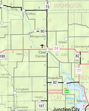
Browndale is a place in Clay County, Kansas, United States. It is known as a ghost town. A ghost town is a place where people used to live, but now almost no one does. It might have old buildings or just empty land. Browndale is located at 39°21′35″N 97°21′03″W / 39.35972°N 97.35083°W.
What is a Ghost Town?
A ghost town is a settlement that has been mostly or completely abandoned. This happens when the things that made people live there, like jobs or resources, go away. People then move to other places.
A Bit of History
Browndale was once located along the Union Pacific Railroad. Railroads were very important in the past. They helped towns grow by bringing in supplies and people. They also helped transport goods to other places. When a railroad line changed or closed, it could cause a town to shrink or even disappear. This is often how a place becomes a ghost town.
 | Lonnie Johnson |
 | Granville Woods |
 | Lewis Howard Latimer |
 | James West |


