
Brownlee, Nebraska facts for kids
Quick facts for kids
Brownlee, Nebraska
|
|
|---|---|
 |
|
| Lua error in Module:Location_map at line 416: Malformed coordinates value. | |
| Country | |
| State | |
| County | Cherry |
| Area | |
| • Total | 0.11 sq mi (0.28 km2) |
| • Land | 0.11 sq mi (0.28 km2) |
| • Water | 0.00 sq mi (0.00 km2) |
| Elevation | 2,871 ft (875 m) |
| Population
(2020)
|
|
| • Total | 13 |
| • Density | 122.64/sq mi (47.19/km2) |
| ZIP code |
69166
|
| Area code(s) | 308 |
| FIPS code | 31-06680 |
| GNIS feature ID | 2583877 |
Brownlee is a very small, unincorporated community in Cherry County, Nebraska, United States. It's a place where people live, but it's not officially a city or town with its own government.
In 2010, about 15 people lived there. Brownlee is located near the North Loup River. It sits about 5 miles west of U.S. Route 83. This area is part of the unique Sandhills region of Nebraska.
The Story of Brownlee
Brownlee got its name from the maiden name of the person who founded it. It was named after the founder's grandmother.
-
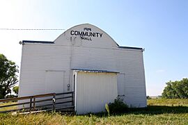
Community Hall
-
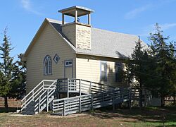
Brownlee church


How Many People Live Here?
The number of people living in Brownlee has changed a little over time.
- In 2010, there were 15 people.
- By 2020, the population was 13 people.
See also
 In Spanish: Brownlee (Nebraska) para niños

All content from Kiddle encyclopedia articles (including the article images and facts) can be freely used under Attribution-ShareAlike license, unless stated otherwise. Cite this article:
Brownlee, Nebraska Facts for Kids. Kiddle Encyclopedia.