Brushy Lake (Sallisaw, Oklahoma) facts for kids
Quick facts for kids Brushy Creek Reservoir |
|
|---|---|
| Brushy Creek Reservoir | |
| Coordinates | 35°32′35″N 94°49′18″W / 35.5430106°N 94.8217692°W |
| Primary inflows | Brushy Creek |
| Primary outflows | Brushy Creek |
| Managing agency | USDA Soil Conservation Service |
| Built | 1963 |
| Surface area | 358 square feet (33.3 m2) |
| Surface elevation | 906 feet (276 m) |
| Settlements | Sallisaw, Oklahoma |
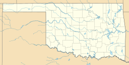
Brushy Lake is a reservoir in Oklahoma. It used to be called Brushy Creek Reservoir. This lake is about eight miles northeast of Sallisaw. It sits on a small stream that flows into Sallisaw Creek.
Around the lake, you'll find Brushy Lake Park. The city of Sallisaw now owns and runs the park and the lake.
Contents
About Brushy Lake
Why Was Brushy Lake Built?
Brushy Lake was created in 1963. The USDA Soil Conservation Service built it. Their main goals were to help with flood control and provide drinking water for Sallisaw.
The lake helps control floods by holding extra water. It also collects water from a large area of land, about 13,256 acres. This water then goes to Sallisaw for people to use.
How Big is Brushy Lake?
Brushy Lake covers an area of 358 acres. It holds a lot of water, about 3,258 acre-feet. The edge of the lake, called the shoreline, is about 4 miles (6.4 km) long. The lake's surface is about 906 feet (276 m) above sea level.
How Does Sallisaw Get Water?
Water from Brushy Lake is pumped to Sallisaw. It travels through a large pipe, about 16 inches wide. This pipe is about six miles long. The water goes to special facilities where it is cleaned.
In 2007, Sallisaw built a new water treatment plant. This plant can clean a huge amount of water, about 6×10⁶ US gallons (2.3×10⁴ m3) every day. The project also added a new structure to take water from the lake and a pumping station to move it.
Fun Things to Do at Brushy Lake Park
Brushy Lake Park offers several things for visitors to enjoy. If you like camping, there are sites with electricity. There are also restrooms available for campers. For those who enjoy being on the water, the park has a boat ramp and a dock.


