Burbank, South Dakota facts for kids
Quick facts for kids
Burbank, South Dakota
|
|
|---|---|

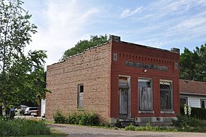
The old Bank of Burbank building
|
|
| Country | United States |
| State | South Dakota |
| County | Clay |
| Area | |
| • Total | 0.31 sq mi (0.80 km2) |
| • Land | 0.31 sq mi (0.80 km2) |
| • Water | 0.00 sq mi (0.00 km2) |
| Elevation | 1,142 ft (348 m) |
| Population
(2020)
|
|
| • Total | 93 |
| • Density | 302.93/sq mi (116.97/km2) |
| Time zone | UTC-6 (Central (CST)) |
| • Summer (DST) | UTC-5 (CDT) |
| ZIP codes |
57010
|
| FIPS code | 46-08500 |
| GNIS feature ID | 2813011 |
Burbank is a very small place in South Dakota, United States. It's called an unincorporated community. This means it doesn't have its own local government like a city or town. It's located in Clay County. In 2020, only 93 people lived there.
History of Burbank
Burbank was first planned out in 1873. It was named after an important person named John A. Burbank. He was the fourth Governor of the Dakota Territory. A "territory" is an area that is not yet a state but is part of the United States. The governor was like the leader of that territory.
Where is Burbank?
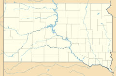
Burbank is in the southeastern part of South Dakota. It's close to the Missouri River. This area is known for its wide-open spaces and farming.
Black History Month on Kiddle
Famous African-American Artists:
 | Delilah Pierce |
 | Gordon Parks |
 | Augusta Savage |
 | Charles Ethan Porter |

All content from Kiddle encyclopedia articles (including the article images and facts) can be freely used under Attribution-ShareAlike license, unless stated otherwise. Cite this article:
Burbank, South Dakota Facts for Kids. Kiddle Encyclopedia.


