Burnfield facts for kids
Quick facts for kids Burnfield |
|
|---|---|
| Alternative name(s) | Rothiemay |
| Type | Marching camp (probable) |
| Location | |
| Coordinates | 57°31′06″N 2°46′02″W / 57.5182°N 2.7672°W |
| Site notes | |
| Discovery year | 1982 |
| Condition | Cropmark |
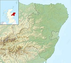
Burnfield is a special place in Aberdeenshire, Scotland. It's located near Milltown of Rothiemay, right by the River Deveron. Experts believe it was once a temporary camp for the Roman army.
This ancient site was first found in 1982. It was discovered using aerial photography, which means taking pictures from an airplane.
What Was Burnfield?
Burnfield is thought to be a 'marching camp.' This was a temporary fort built by Roman soldiers when they were on the move. They would build these camps quickly to protect themselves overnight or for a short time.
How Big Was the Camp?
The exact size of the camp at Burnfield isn't fully known. But we do know it covered at least 9.72 hectares (about 24 acres). It probably wasn't much bigger than 16 hectares (about 40 acres).
The Camp's Defenses
Archaeologists have found that the ditch around the camp was only about 0.69 meters (2.3 feet) deep. This depth is similar to other Roman camps found nearby, like those at Auchinhove and Ythan Wells. A shallower ditch might mean the camp was built very quickly or for a short stay.
Discovering Ancient History
The camp at Burnfield was discovered from the air. When crops grow over old buried structures, they sometimes show different patterns. This is called a cropmark. These marks can reveal hidden ancient sites like Roman camps.
 | Frances Mary Albrier |
 | Whitney Young |
 | Muhammad Ali |


