Bury Walls facts for kids

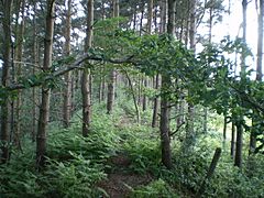
Rampart of Bury Walls
|
|
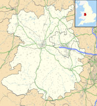
| Location | Near Weston-under-Redcastle, Shropshire |
|---|---|
| Coordinates | 52°50′34″N 2°37′43″W / 52.84278°N 2.62861°W |
| Altitude | 160 m (525 ft) |
| Type | Hillfort |
| Length | 520 metres (1,710 ft) |
| Width | 380 metres (1,250 ft) |
| Area | 8 hectares (20 acres) |
| History | |
| Periods | Iron Age |
| Designated | 17 December 1929 |
| Reference no. | 1020284 |
| Identifiers | |
| Atlas of Hillforts | 0048 |
Bury Walls is an ancient place called a hillfort. It was built a long, long time ago during the Iron Age in Britain. You can find it about 1 mile (1.6 km) south-east of Weston-under-Redcastle in Shropshire, England. It's a special place, protected by the government as a scheduled monument, which means it's an important historical site.
Contents
What is Bury Walls?
Bury Walls is a type of ancient fort called a hillfort. It sits on a high piece of land that sticks out, facing towards the south-west. This land is part of a larger sandstone ridge. The fort is about 160 meters (525 feet) above sea level.
How Big is the Fort?
The area inside the fort is quite large. It measures about 520 meters (1,706 feet) from north to south and 380 meters (1,247 feet) from east to west. This means the whole area inside is about 8 hectares (20 acres) – that's like 11 football fields!
What Did the Fort Look Like?
The fort was naturally protected by steep slopes on most sides. But on the north side, where the ground was flatter, the builders created two huge walls of earth and ditches. These are called ramparts and ditches. The inner rampart was about 7.8 meters (25.6 feet) tall, much higher than the ground inside the fort.
Around the rest of the fort, there was a single rampart along the edge of the high ground. On the east side, it was about 3 meters (9.8 feet) tall, and on the west side, it was up to 1.8 meters (5.9 feet) tall.
From inside the fort, people would have had amazing views to the south. There was also a natural spring inside, which would have provided fresh water. The main way to get into the fort was through an entrance near the north-east corner, which was about 5 meters (16.4 feet) wide.
Discoveries at Bury Walls
Archaeologists have explored Bury Walls to learn more about its past.
Early Digs in 1930
In 1930, a person named E. W. Bowcock did some digging at the site. Near the main entrance, they found marks in the bedrock that looked like cart ruts. This suggests that carts or wagons regularly entered and exited the fort.
They also found two areas with broken stones, which might have been places where people made fires, like ancient hearths. A possible quern-stone was also found. A quern-stone is a special stone used to grind grain into flour, just like a very old-fashioned blender!
Near the center of the fort, they found the foundations of a building. At first, people thought it was from the Middle Ages. But more recently, experts think it might have been part of a Romano-Celtic temple. This would be a temple that mixed Roman and Celtic styles.
Modern Surveys in 1999 and 2000
More recently, in 1999 and 2000, scientists used special tools to survey the site. They did geophysical surveys, which use technology to look underground without digging. They also did topographical surveys, which map the shape of the land.
These surveys showed that in the northern part of the fort, there were several large, circular terraces. It looks like the earth and stone dug out to create these terraces were then used to build the huge defensive walls around the fort.
 | Georgia Louise Harris Brown |
 | Julian Abele |
 | Norma Merrick Sklarek |
 | William Sidney Pittman |


