Butterfield, Texas facts for kids
Quick facts for kids
Butterfield, Texas
|
|
|---|---|
| Country | United States |
| State | Texas |
| County | El Paso |
| Area | |
| • Total | 3.2 sq mi (8.2 km2) |
| • Land | 3.2 sq mi (8.2 km2) |
| • Water | 0.0 sq mi (0.0 km2) |
| Elevation | 4,393 ft (1,339 m) |
| Population
(2020)
|
|
| • Total | 100 |
| • Density | 31/sq mi (12/km2) |
| Time zone | UTC-7 (Mountain (MST)) |
| • Summer (DST) | UTC-6 (MDT) |
| ZIP Code |
79938
|
| FIPS code | 48-11626 |
| GNIS feature ID | 2407930 |
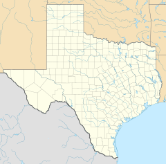
Butterfield is a small community in El Paso County, Texas, in the United States. It's known as a census-designated place (CDP). This means it's an area that looks like a town but isn't officially set up as one.
In 2020, about 100 people lived in Butterfield. It's part of the larger El Paso area. The special mail code for this area is 79938.
Where is Butterfield Located?
Butterfield is in El Paso County, Texas. It covers a total area of about 3.2 square miles (8.2 square kilometers). All of this area is land, with no large bodies of water.
How Many People Live Here?
The number of people living in Butterfield has changed over the years.
| Historical population | |||
|---|---|---|---|
| Census | Pop. | %± | |
| 2000 | 61 | — | |
| 2010 | 114 | 86.9% | |
| 2020 | 100 | −12.3% | |
| U.S. Decennial Census 1850–1900 1910 1920 1930 1940 1950 1960 1970 1980 1990 2000 2010 2020 |
|||
- In 2000, there were 61 people.
- By 2010, the population grew to 114 people.
- In 2020, the population was 100 people.
Schools in Butterfield
Students in Butterfield attend schools that are part of the Clint Independent School District. This school district serves several communities in the area.
See also
- Butterfield for kids (in Spanish)
Black History Month on Kiddle
Famous African-American Scientists:
 | Dorothy Vaughan |
 | Charles Henry Turner |
 | Hildrus Poindexter |
 | Henry Cecil McBay |

All content from Kiddle encyclopedia articles (including the article images and facts) can be freely used under Attribution-ShareAlike license, unless stated otherwise. Cite this article:
Butterfield, Texas Facts for Kids. Kiddle Encyclopedia.

