
Cactus Forest, Arizona facts for kids
Quick facts for kids
Cactus Forest, Arizona
|
|
|---|---|

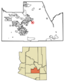
Location of Cactus Forest in Pinal County, Arizona.
|
|

Cactus Forest, Arizona
Location in the United States
|
|
| Country | United States |
| State | Arizona |
| County | Pinal |
| Area | |
| • Total | 2.73 sq mi (7.08 km2) |
| • Land | 2.73 sq mi (7.08 km2) |
| • Water | 0.00 sq mi (0.00 km2) |
| Population
(2020)
|
|
| • Total | 606 |
| • Density | 221.82/sq mi (85.64/km2) |
| Time zone | UTC-7 (MST (no DST)) |
| ZIP code |
85132
|
| Area code(s) | 520 |
| FIPS code | 04-08990 |
Cactus Forest is a small community in Pinal County, Arizona, United States. It is known as a census-designated place (CDP). This means it's an area that looks like a town but doesn't have its own local government. The government counts the people living there for official records.
In 2010, about 594 people lived in Cactus Forest. By 2020, the population had grown slightly to 606 people.
About Cactus Forest
Cactus Forest is located in the state of Arizona. It's part of Pinal County. The area is known for its desert landscape, which often includes many cactus plants.
Population Changes
| Historical population | |||
|---|---|---|---|
| Census | Pop. | %± | |
| 2010 | 594 | — | |
| 2020 | 606 | 2.0% | |
| U.S. Decennial Census | |||
Cactus Forest was first officially counted as a CDP in the 2010 U.S. Census. This was the first time it appeared as a separate area for population counting.
Since then, its population has stayed fairly steady. In 2010, there were 594 people. By 2020, the number had increased to 606 people. This shows a small but steady growth in the community.
Images for kids
-
This map shows where Cactus Forest is located within Pinal County, Arizona.
See also
 In Spanish: Cactus Forest para niños
