Caleruela facts for kids
Quick facts for kids
Caleruela
|
|||
|---|---|---|---|
|
|||
 |
|||
| Country | Spain | ||
| Autonomous community | Castile-La Mancha | ||
| Province | Toledo | ||
| Municipality | Caleruela | ||
| Area | |||
| • Total | 9 km2 (3 sq mi) | ||
| Elevation | 322 m (1,056 ft) | ||
| Population
(2018)
|
|||
| • Total | 210 | ||
| • Density | 23.3/km2 (60/sq mi) | ||
| Time zone | UTC+1 (CET) | ||
| • Summer (DST) | UTC+2 (CEST) | ||
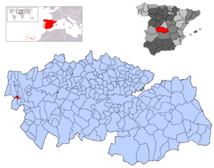
Caleruela is a small town, also called a municipality, located in Spain. It is found in the province of Toledo, which is part of the Castile-La Mancha region. In 2023, about 202 people lived in Caleruela. It covers an area of 9 square kilometers (about 3.5 square miles).
Population Changes Over Time
The study of how populations change is called demographics. Caleruela's population has changed a lot over the years.
In the early 1900s, the town grew quite a bit. Its population reached its highest point in the 1950s, with over 1,100 people living there. After that, the number of people living in Caleruela started to decrease. This kind of change can happen for many reasons, like people moving to bigger cities for work or education.
Here is a look at how the population has changed:
| Historical population | ||
|---|---|---|
| Year | Pop. | ±% |
| 1900 | 491 | — |
| 1910 | 800 | +62.9% |
| 1920 | 815 | +1.9% |
| 1930 | 1,002 | +22.9% |
| 1940 | 1,050 | +4.8% |
| 1950 | 1,119 | +6.6% |
| 1960 | 1,046 | −6.5% |
| 1970 | 649 | −38.0% |
| 1981 | 463 | −28.7% |
| 1991 | 361 | −22.0% |
| 2001 | 296 | −18.0% |
| 2011 | 283 | −4.4% |
| 2021 | 214 | −24.4% |
| 2023 | 202 | −5.6% |
| Source: INE | ||
See also
 In Spanish: Caleruela para niños


