California Historical Landmarks in San Benito County facts for kids
California is full of amazing places that tell stories about the past! In San Benito County, located in Northern California, you can find several special spots known as California Historical Landmarks. These landmarks are like official badges of honor given to places that are super important to California's history. They help us remember and learn about the people and events that shaped our state.
Imagine visiting places where explorers stood, where important decisions were made, or where communities first grew. That's what these landmarks offer! They are protected so that everyone, including you, can visit and discover the fascinating history right here in San Benito County.
Contents
Exploring History in San Benito County
San Benito County is home to several officially recognized historical landmarks. Each one has a unique story, from towering peaks where explorers made discoveries to old buildings that show us how people lived long ago. Let's take a closer look at some of these cool places!
Famous Landmarks You Can Visit
Fremont Peak: A High View of History
Fremont Peak is a tall mountain that offers amazing views of the surrounding area. It's located in Fremont Peak State Park near San Juan Bautista. This peak is named after John C. Frémont, an American explorer. In 1846, he raised the American flag here during a time when California was still part of Mexico. This event was a small but important part of the bigger story of California becoming a part of the United States. Today, you can hike to the top and enjoy the same incredible views that Frémont saw!
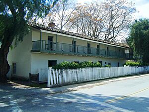
Jose Castro House: A Home from the Past
The Jose Castro House is a beautiful old adobe building found within San Juan Bautista State Historic Park in San Juan Bautista. Jose Castro was a very important person in California's history. He was a military commander and politician when California was still under Mexican rule. This house was his home and a place where many important discussions happened. Visiting this house is like stepping back in time to see how a prominent family lived in the 1800s.
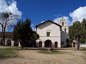
Mission San Juan Bautista: A Spiritual Center
Mission San Juan Bautista is one of the 21 historic Spanish missions built in California. It was founded in 1797 and is located at 2nd and Mariposa Streets in San Juan Bautista. This mission was an important center for religion and community life for many years. It's known for its beautiful architecture and its long history. The mission church is still active today, and you can visit to learn about its past and see its lovely grounds.
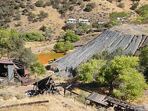
New Idria Mine: A Mining Town's Story
The New Idria Mine is an old mercury mine located near the town of New Idria. This mine was once one of the largest mercury mines in the world! Mercury was a very important metal used for many things, including extracting gold during the California Gold Rush. The mine operated for many years, creating a bustling town around it. Today, the mine is no longer active, but it stands as a reminder of California's rich mining history and the hard work of the people who lived and worked there.
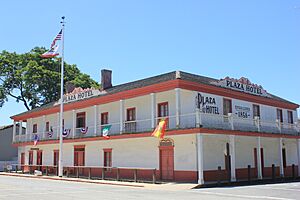
Plaza Hotel: A Traveler's Stop
The Plaza Hotel is another historic building located within San Juan Bautista State Historic Park in San Juan Bautista. This hotel was built in the 1850s and served as a popular stop for travelers, stagecoaches, and merchants passing through the area. Imagine people arriving by horse and buggy, staying overnight, and sharing news from other towns! The Plaza Hotel gives us a glimpse into what travel and hospitality were like in early California. It's a great place to learn about the daily lives of people from long ago.


