San Juan Bautista, California facts for kids
Quick facts for kids
San Juan Bautista
|
||
|---|---|---|
| City of San Juan Bautista | ||
|
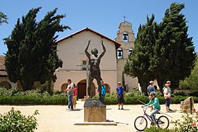
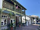
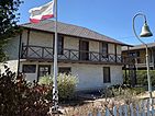
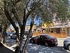
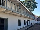
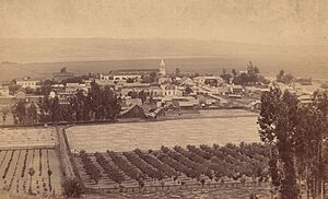
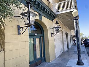
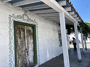
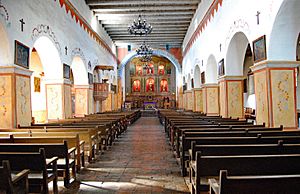
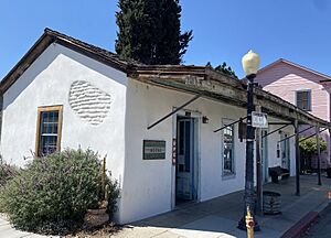
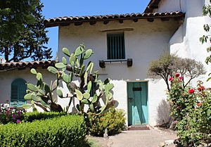
Clockwise: Mission San Juan Bautista; the Pico-Boronda Adobe; José Castro House; Downtown San Juan Bautista; Jardines de San Juan.
|
||
|
||
| Motto(s):
City of History
|
||
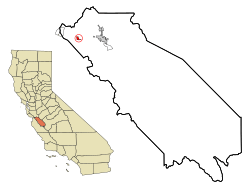
Location in San Benito County and the state of California
|
||
| Country | United States | |
| State | California | |
| County | San Benito | |
| Incorporated | May 4, 1896 | |
| Named for | Saint John the Baptist | |
| Area | ||
| • Total | 0.79 sq mi (2.03 km2) | |
| • Land | 0.79 sq mi (2.03 km2) | |
| • Water | 0.00 sq mi (0.00 km2) 0.06% | |
| Elevation | 217 ft (66 m) | |
| Population
(2020)
|
||
| • Total | 2,089 | |
| • Estimate
(2019)
|
2,104 | |
| • Density | 2,680.25/sq mi (1,035.29/km2) | |
| Time zone | UTC-8 (Pacific) | |
| • Summer (DST) | UTC-7 (PDT) | |
| ZIP code |
95045
|
|
| Area code | 831 | |
| FIPS code | 06-68014 | |
| GNIS feature IDs | 1659581, 2411792 | |
San Juan Bautista is a city in San Benito County, California. Its name means "Saint John the Baptist" in Spanish. In 2020, about 2,089 people lived there.
The city was started in 1797 by the Spanish. They built Mission San Juan Bautista there. After Mexico took control in 1833, the town was briefly called San Juan de Castro. It officially became a city in 1896. Today, San Juan Bautista is a popular place for tourists. It has many old historic sites, like the San Juan Bautista State Historic Park. It is also home to El Teatro Campesino, a famous theater group.
Contents
History of San Juan Bautista
Before Europeans arrived, the area was home to the Mutsun people. They were a tribe of the Ohlone Nation, who are Indigenous Californians. The Mutsuns lived in villages. Their homes were huts made from willow and native grasses.
Spanish Rule and the Mission
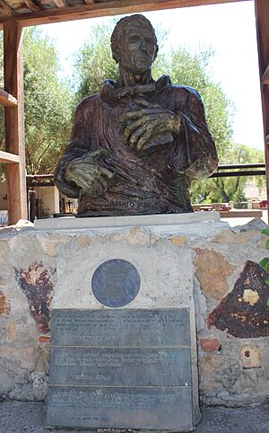
In 1797, a Spanish Franciscan priest named fray Fermín de Lasuén came to the area. He founded Mission San Juan Bautista. His goal was to teach the native people about Catholicism. By doing this, he claimed the land for the Spanish Empire. Lasuén chose this spot because it had good farmland, a steady water supply, and many native people.
Building the main mission church began in 1803. It has been used continuously since 1812. The mission was located on the Camino Real. This was a "royal highway" that connected all the California missions. It was an important road for many years.
Mexican Independence and Changes
In 1821, Mexico fought for and won its independence from Spain. This made California a part of the new country of Mexico. By 1834, a town called San Juan de Castro had grown around the mission. It was named after José Tiburcio Castro, a leader in the town.
In 1834, the mission lands were taken from the church. This process was called secularization. José Tiburcio Castro was put in charge of the mission property. He divided the land and sold it off. His son, José Castro, built the Castro Adobe house in 1840. José Castro was often busy with government work and did not spend much time there. He was important in removing governors Nicolás Gutiérrez in 1836 and Manuel Micheltorena in 1844.
After defeating Micheltorena, José Antonio Castro became the top military leader in California. From San Juan Bautista, he watched for any foreign armies trying to enter California. He paid close attention to John C. Frémont, an American military officer. Frémont was allowed into California to explore the land. However, he was told to stay away from coastal towns. Frémont broke this rule by going to Monterey. Castro told Frémont to leave the country. Frémont refused and set up a camp on Gavilán Peak, which overlooked San Juan. Luckily, no fighting happened, and Frémont eventually left.
Becoming Part of the United States
San Juan Bautista officially became a city on May 4, 1896.
In 1904, a flying pioneer named John J. Montgomery tested his glider in San Juan. This glider was a model for his 1905 gliders. These later gliders made the first successful high-altitude flights in flying machines heavier than air.
Scientists recently used old photos to figure out where the 1906 San Francisco earthquake started. They believe it was either off the coast of San Francisco or near San Juan Bautista. This matches earlier ideas.
In 1930, the last person who spoke the Mutsun language, Ascención Solórzano de Cervantes, passed away. This meant the Mutsun language became extinct.
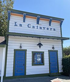
In 1971, Luis Valdez moved El Teatro Campesino to San Juan. This theater group is very important to the Chicano Movement. They first used La Calavera Theatre and later built a larger one called El Teatro Campesino.
Geography and Climate
The city covers about 0.7 square miles (2.03 square kilometers). Almost all of it is land.
The Gabilán Range mountains are to the south of San Juan Bautista. The famous San Andreas Fault runs through the city. Fremont Peak, which overlooks the town, is a public park called Fremont Peak State Park.
Weather in San Juan Bautista
San Juan Bautista has warm, dry summers. The average monthly temperature does not go above 71.6°F (22°C). This type of weather is called a warm-summer Mediterranean climate.
Population Information
| Historical population | |||
|---|---|---|---|
| Census | Pop. | %± | |
| 1880 | 484 | — | |
| 1890 | 463 | −4.3% | |
| 1900 | 449 | −3.0% | |
| 1910 | 326 | −27.4% | |
| 1920 | 501 | 53.7% | |
| 1930 | 772 | 54.1% | |
| 1940 | 678 | −12.2% | |
| 1950 | 1,031 | 52.1% | |
| 1960 | 1,046 | 1.5% | |
| 1970 | 1,164 | 11.3% | |
| 1980 | 1,276 | 9.6% | |
| 1990 | 1,570 | 23.0% | |
| 2000 | 1,549 | −1.3% | |
| 2010 | 1,862 | 20.2% | |
| 2019 (est.) | 2,104 | 13.0% | |
| U.S. Decennial Census | |||
Population in 2010
In 2010, San Juan Bautista had 1,862 people. Most people (99.7%) lived in homes, while a few lived in group housing.
- About 60.4% of the people were White.
- About 48.7% of the people were Hispanic or Latino.
- About 23.1% of the people were under 18 years old.
- The average age was 38.7 years.
There were 681 households. About 50.7% of these were married couples. About 23.1% of households had only one person. The average household had 2.73 people.
Population in 2000
In 2000, there were 1,549 people in San Juan Bautista.
- About 27.9% of the people were under 18 years old.
- The average age was 36 years.
The median income for a household was $43,355. This means half of the households earned more and half earned less. About 15.5% of the population lived below the poverty line.
Economy and Local Features
San Juan Bautista is mainly a farming community. However, it also has a strong tourism industry. This is because of its many historic and cultural places.
Earthbound Farm, a company based in San Juan, is the biggest producer of organic salads in the United States.
The Fremont Peak Observatory is located on top of Fremont Peak. It is a non-profit place for looking at stars. It serves the local community.
Media and Local Information
CMAP TV runs several local TV channels (17, 18, 19 & 20) on Charter/Spectrum Cable. They also stream online. These channels provide public access and educational programs for Gilroy and San Benito County. They also show live meetings of the San Juan Bautista City Council.
Famous People from San Juan Bautista
- Amalia Mesa-Bains, an artist and writer
- Luis Valdez, known for his work in Chicano films and founding El Teatro Campesino
- Robert J. Mazzuca, a former CEO of the Boy Scouts of America
- Rowena Meeks Abdy, a modernist painter
- Salomón Pico, a historical figure sometimes called a "Robin Hood"
Historical Landmarks to Visit
- San Juan Bautista State Historic Park
- Mission San Juan Bautista (built 1797)
- Plaza Hotel (built 1813)
- José Castro House (built 1838)
- Juan de Anza House (built 1830)
- Marentis House (built 1873)
- Rozas House (built 1856)
- Benjamin Wilcox House (built 1858)
- San Juan Jail (built 1870)
- San Juan Bautista Third Street Historic District
- Juan Bautista de Anza National Historic Trail
See also
 In Spanish: San Juan Bautista (California) para niños
 | Emma Amos |
 | Edward Mitchell Bannister |
 | Larry D. Alexander |
 | Ernie Barnes |


