
Gabilan Range facts for kids
Quick facts for kids Gabilan Range |
|
|---|---|

Gabilan Range panorama.
|
|
| Highest point | |
| Peak | Fremont Peak |
| Elevation | 1,053 m (3,455 ft) |
| Geography | |

Location in California
|
|
| Country | United States |
| State | California |
| District | San Benito County & Monterey County |
| Range coordinates | 36°36′39.864″N 121°18′52.750″W / 36.61107333°N 121.31465278°W |
| Topo map | USGS Mount Johnson |
The Gabilan Range (also called the Gabilan Mountains) is a cool group of mountains in central California. These mountains are part of the larger California Coast Ranges system. You can find them mostly in Monterey County and San Benito County. A super interesting place, Pinnacles National Park, is located right in the southern part of this mountain range.
Where are the Gabilan Mountains?

The Gabilan Range stretches in a long line from the northwest to the southeast. It forms a natural border between Monterey County and San Benito County.
To the east, the Gabilan Mountains are next to the Diablo Range and the famous San Andreas Fault. This fault is a huge crack in the Earth's crust! On the western side, you'll find the Salinas Valley and the Santa Lucia Range.
The highest point in the Gabilan Range is Fremont Peak. It stands tall at about 1,053 meters (or 3,455 feet) high. There are also several other peaks in the range that are over 914 meters (3,000 feet) tall.
What's in a Name? And Famous Stories!
The name Gabilan comes from an old Spanish word, gavilán. This word means "sparrow hawk." It makes sense because many kinds of hawks, especially the red-tailed hawk, live in these mountains. You can often spot them soaring high above the peaks!
These mountains are also famous because they appear in books by a well-known American writer, John Steinbeck. He wrote about the Gabilan Mountains and other nearby places in his novels. Some of his famous books that mention the area include Of Mice and Men and East of Eden. In his book The Red Pony, the main character even names his pony "Gabilan" after this very mountain range!
Images for kids
-
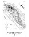
Geologic map of the pre-Cenozoic basement rocks of the Gabilan Range in Monterey and San Benito Counties, California

