Campbell, North Carolina facts for kids
Quick facts for kids
Campbell
|
|
|---|---|
| Country | United States |
| State | North Carolina |
| County | Stokes |
| Time zone | UTC-5 (Eastern (EST)) |
| • Summer (DST) | UTC-4 (EDT) |
| ZIP code |
27022
|
Campbell is a small place in North Carolina, United States. It is known as an "unincorporated community." This means it is a group of homes and businesses that are not officially a town or city.
Contents
What is an Unincorporated Community?
An unincorporated community is a place where people live, but it doesn't have its own local government. It is not run by a mayor or a city council. Instead, it is usually part of a larger county.
How is Campbell Governed?
Since Campbell is unincorporated, it is governed by Stokes County. The county government handles things like roads, public safety, and other services for the community. This is different from a city, which would have its own police and fire departments.
Where is Campbell Located?
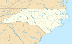
Campbell is found in the northern part of North Carolina. It is specifically located within Stokes County. Stokes County is in the central-northern area of the state.
Geographic Coordinates
You can find Campbell on a map using its special geographic coordinates. These are like an address for the Earth! Campbell is located at 36 degrees, 31 minutes, 40 seconds North latitude. It is also at 80 degrees, 14 minutes, 14 seconds West longitude.
Time Zone Information
Campbell is in the Eastern Time Zone. During most of the year, this is called Eastern Standard Time (EST). This means it is 5 hours behind UTC. In the summer, people in Campbell observe Daylight Saving Time. This is called Eastern Daylight Time (EDT). During EDT, it is 4 hours behind UTC.
Quick Facts About Campbell
Here are some quick facts about Campbell based on official records:
- Location: Stokes County, North Carolina, USA
- Type: Unincorporated community
- Postal Code: The main ZIP code for Campbell is 27022. This helps mail get to the right place.
- Official IDs: Campbell has special identification numbers. These include a FIPS code and a GNIS feature ID. These numbers help government agencies track places.
 | Toni Morrison |
 | Barack Obama |
 | Martin Luther King Jr. |
 | Ralph Bunche |


