Canaan River (New Brunswick) facts for kids
Quick facts for kids Canaan River |
|
|---|---|
 |
|
| Country | Canada |
| Province | New Brunswick |
| Region | Southern New Brunswick |
| Physical characteristics | |
| Main source | Saint John River |
| River mouth | Saint John River on Bay of Fundy |
| Basin features | |
| River system | Bay of Fundy drainage basin |
| Tributaries |
|
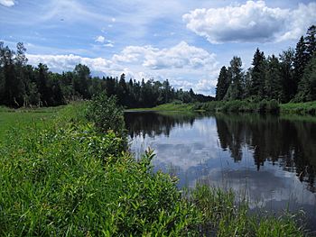
The Canaan River is an important river located in the southeastern part of New Brunswick, Canada. It plays a key role in the local environment. The river's waters flow into Washademoak Lake. From there, they drain into the larger Saint John River. This entire river system eventually reaches the Bay of Fundy.
The Canaan River is fed by 17 smaller streams, called tributaries. These tributaries all contribute water to the main river. The total area that collects water for the Canaan River is called its watershed. This watershed is quite large, covering about 2,167 square kilometers.
Communities Along the Canaan River
Many small communities are located along the Canaan River. These towns and villages are part of the river's story and history.
- Canaan Station, New Brunswick
- New Canaan, New Brunswick
- Cherryvale, New Brunswick
- Canaan Forks, New Brunswick
- Phillipstown, New Brunswick
- Brookvale, New Brunswick
- Canaan Rapids, New Brunswick
- Coles Island, New Brunswick
- Chambres Corner, New Brunswick
- Thometown, New Brunswick
Roads Crossing the River
Several roads and highways cross over the Canaan River. These crossings help people travel and connect different areas of New Brunswick.
- New Brunswick Route 112
- New Brunswick Route 126
- New Brunswick Route 2
- New Brunswick Route 10
- New Brunswick Route 715
- New Brunswick Route 710

