Cape Buller facts for kids
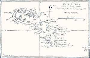
Cape Buller is a rugged piece of land that sticks out into the sea on the north coast of South Georgia. It forms the western side of the entrance to a place called the Bay of Isles. This area was first explored and named in 1775 by a British team led by Captain James Cook.
Contents
Exploring Cape Buller and Nearby Areas
Cape Buller is an important landmark on the northern coast of South Georgia. It's known for its rough, rocky shape.
What is Macdonald Cove?
Just west of Cape Buller, you'll find Macdonald Cove. This cove is about 4.6 kilometers (2.5 nautical miles) south-southeast of the Welcome Islands. Macdonald Cove is special because it has important fossils found around its edges.
The UK Antarctic Place-Names Committee named this cove in 1982. It was named after David I.M. Macdonald. He was a British Antarctic Survey geologist. Geologists study rocks and the Earth. David Macdonald was in charge of field work on South Georgia during 1975–76 and 1976–77.
Sitka Bay and Buller Bay
Even further west of Macdonald Cove, about 1.8 kilometers (1 nautical mile) from Cape Buller, is Sitka Bay. For many years, maps showed this area with two different names: Sitka Bay and Buller Bay.
To clear up the confusion, the South Georgia Survey explored the area in 1951 and 1952. They found that local people called this feature Sitka Bay. Because of this local knowledge, the name Sitka Bay was officially approved.
See also
 In Spanish: Cabo Buller para niños
 | Mary Eliza Mahoney |
 | Susie King Taylor |
 | Ida Gray |
 | Eliza Ann Grier |


