Cape Robertson facts for kids
Quick facts for kids Cape Robertson |
|
|---|---|
| Coordinates | 60°44′S 44°48′W / 60.733°S 44.800°W |
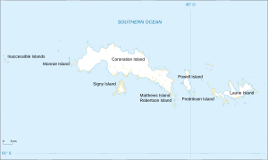
Cape Robertson is a special piece of land, or a "cape," located in Antarctica. It's found on the northwest side of Laurie Island. This island is part of the South Orkney Islands. Cape Robertson acts like a natural marker, showing the western entrance to a place called Jessie Bay.
Contents
Where is Cape Robertson Located?
Cape Robertson is about 2 kilometers (1.2 miles) east of Route Point. Route Point is at the northern tip of Mackenzie Peninsula. These places are all found on Laurie Island.
How Cape Robertson Got Its Name
The name "Cape Robertson" has an interesting history. On an old map of Laurie Island, made between 1902 and 1904, the name Cape Robertson was actually placed where Route Point is today. Route Point had already been named in 1821 by Captain George Powell and Captain Nathaniel Palmer.
To avoid confusion, the name Route Point was kept for the northwest end of Mackenzie Peninsula. Cape Robertson was then officially given to the northeast tip of the area. The cape is named after Thomas Robertson. He was the captain of the ship Scotia. This ship was used during the Scottish National Antarctic Expedition.
An Important Place for Birds
Cape Robertson is very important for wildlife. About 388 hectares (959 acres) of this area has been named an Important Bird Area (IBA). This special title was given by BirdLife International.
Home to Chinstrap Penguins
The reason it's an Important Bird Area is because it's home to a huge bird colony. Around 20,000 pairs of chinstrap penguins come here to breed. This means many penguin families live and raise their young at Cape Robertson.


