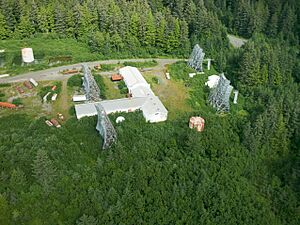
Cape Yakataga, Alaska facts for kids
Cape Yakataga is a small community located in Alaska, a state in the United States. It's part of the City and Borough of Yakutat. You might also hear it called simply Yakataga. This place is very close to the ocean, and its land is only about 20 feet (6 m) above sea level.
The name Yakataga comes from a Native American language. It means "canoe road." This name refers to two natural reefs, which are like underwater rock formations. These reefs create a special passage for canoes to reach the village. A United States Post Office was set up here in 1935, helping people send and receive mail.
Cape Yakataga used to have an airport called Yakataga Airport. Until 2012, small planes would fly there regularly, with some help from a U.S. government program. This program, called the Essential Air Service, made sure even small, faraway places had air travel. However, the flights stopped because officials found that no one was living there permanently anymore.
About the People of Yakataga
Yakataga was listed in the U.S. Census once, in 1960. At that time, 48 people lived there. Today, it is part of the larger City and Borough of Yakutat. This means it's no longer counted as a separate village in the same way.
| Historical population | |||
|---|---|---|---|
| Census | Pop. | %± | |
| 1960 | 48 | — | |
| U.S. Decennial Census | |||
Weather in Cape Yakataga
Cape Yakataga has a type of weather called a subarctic climate. This means it has long, cold winters and short, cool summers. It's a climate often found in northern parts of the world, just below the Arctic regions.
| Climate data for Cape Yakataga | |||||||||||||
|---|---|---|---|---|---|---|---|---|---|---|---|---|---|
| Month | Jan | Feb | Mar | Apr | May | Jun | Jul | Aug | Sep | Oct | Nov | Dec | Year |
| Record high °F (°C) | 59 (15) |
54 (12) |
55 (13) |
66 (19) |
70 (21) |
75 (24) |
78 (26) |
72 (22) |
71 (22) |
61 (16) |
59 (15) |
53 (12) |
78 (26) |
| Mean maximum °F (°C) | 44.8 (7.1) |
44.8 (7.1) |
46.8 (8.2) |
53.7 (12.1) |
60.1 (15.6) |
63.1 (17.3) |
66.3 (19.1) |
65.2 (18.4) |
62.7 (17.1) |
55.5 (13.1) |
49.6 (9.8) |
45.2 (7.3) |
69.0 (20.6) |
| Mean daily maximum °F (°C) | 32.8 (0.4) |
36.8 (2.7) |
39.1 (3.9) |
43.8 (6.6) |
49.4 (9.7) |
54.5 (12.5) |
58.3 (14.6) |
58.3 (14.6) |
54.8 (12.7) |
47.2 (8.4) |
39.3 (4.1) |
34.4 (1.3) |
45.7 (7.6) |
| Daily mean °F (°C) | 26.9 (−2.8) |
30.0 (−1.1) |
32.6 (0.3) |
37.3 (2.9) |
43.2 (6.2) |
49.1 (9.5) |
53.0 (11.7) |
52.7 (11.5) |
48.7 (9.3) |
41.1 (5.1) |
34.0 (1.1) |
29.4 (−1.4) |
39.8 (4.3) |
| Mean daily minimum °F (°C) | 21.1 (−6.1) |
24.1 (−4.4) |
26.1 (−3.3) |
30.7 (−0.7) |
37.0 (2.8) |
43.8 (6.6) |
48.0 (8.9) |
47.1 (8.4) |
42.7 (5.9) |
35.3 (1.8) |
28.9 (−1.7) |
24.3 (−4.3) |
34.1 (1.2) |
| Mean minimum °F (°C) | 5.9 (−14.5) |
9.1 (−12.7) |
12.7 (−10.7) |
22.0 (−5.6) |
29.0 (−1.7) |
36.1 (2.3) |
40.6 (4.8) |
38.3 (3.5) |
32.7 (0.4) |
25.7 (−3.5) |
17.0 (−8.3) |
10.8 (−11.8) |
2.0 (−16.7) |
| Record low °F (°C) | −9 (−23) |
−5 (−21) |
−11 (−24) |
5 (−15) |
20 (−7) |
32 (0) |
36 (2) |
30 (−1) |
28 (−2) |
14 (−10) |
4 (−16) |
−2 (−19) |
−11 (−24) |
| Average precipitation inches (mm) | 6.80 (173) |
7.12 (181) |
5.05 (128) |
6.15 (156) |
5.52 (140) |
4.64 (118) |
5.55 (141) |
8.34 (212) |
13.22 (336) |
14.83 (377) |
11.27 (286) |
10.78 (274) |
99.27 (2,521) |
| Average snowfall inches (cm) | 18.2 (46) |
21.3 (54) |
16.3 (41) |
5.1 (13) |
0.7 (1.8) |
0.0 (0.0) |
0.0 (0.0) |
0.0 (0.0) |
0.0 (0.0) |
2.7 (6.9) |
8.2 (21) |
23.3 (59) |
95.7 (243) |
| Source: WRCC | |||||||||||||
 | Audre Lorde |
 | John Berry Meachum |
 | Ferdinand Lee Barnett |


