Caraga facts for kids
Quick facts for kids
Caraga
Caraga Administrative Region
Region XIII |
|
|---|---|
|
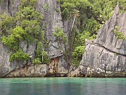
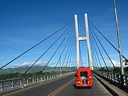
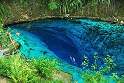
From top, left to right: A lagoon in Dinagat Islands; Tinuy-an Falls; Siargao Island; Macapagal Bridge in Butuan; Bayugan rotunda; Hinatuan Enchanted River
|
|
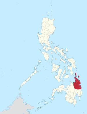
Location in the Philippines
|
|
| Country | Philippines |
| Island group | Mindanao |
| Regional center | Butuan |
| Area | |
| • Total | 21,478.35 km2 (8,292.84 sq mi) |
| Population
(2015)
|
|
| • Total | 2,596,709 |
| • Density | 120.89891/km2 (313.12673/sq mi) |
| Time zone | UTC+8 (PST) |
| ISO 3166 code | PH-13 |
| Provinces |
5
|
| Cities |
6
Bayugan
Bislig Butuan Cabadbaran Surigao City Tandag |
| Municipalities | 70 |
| Barangays | 1,310 |
Caraga is an administrative region in the Philippines. It is also known as Region XIII. This region is found on the northeastern part of Mindanao, which is a large island in the southern Philippines. Butuan City is the main center for the region's government and activities.
Caraga is made up of five different provinces. These are Agusan del Norte, Agusan del Sur, Dinagat Islands, Surigao del Norte, and Surigao del Sur.
Contents
What is Caraga?
Caraga is one of the many regions that help organize the country of the Philippines. Think of a region as a big area that groups together several provinces and cities. This helps the government manage things better across the country. Caraga is special because it is known for its beautiful natural places and rich culture.
Where is Caraga Located?
Caraga is in the northeastern part of the island of Mindanao. This means it's on the side of Mindanao that faces the Pacific Ocean. Its location makes it a gateway to many islands and coastal areas. The region has a mix of mountains, rivers, and a long coastline.
Provinces and Cities in Caraga
Caraga is home to five provinces. Each province has its own capital city or town.
- Agusan del Norte
- Agusan del Sur
- Dinagat Islands
- Surigao del Norte
- Surigao del Sur
Besides these provinces, Caraga also has six important cities:
- Bayugan
- Bislig
- Butuan (the regional center)
- Cabadbaran
- Surigao City
- Tandag
These cities are centers for trade, education, and local government.
People and Culture of Caraga
In 2015, about 2.6 million people lived in the Caraga region. The people of Caraga come from different ethnic groups. One of these groups is the Manobo people. They have a rich culture with unique traditions, dances, and music. Festivals are often held to celebrate their heritage and community.
Amazing Places to Visit in Caraga
Caraga is famous for its stunning natural attractions. Many tourists visit the region to see its beautiful landscapes.
Natural Wonders
- Tinuy-an Falls: This is a very wide waterfall in Bislig, Surigao del Sur. It is often called the "Niagara Falls of the Philippines."
- Hinatuan Enchanted River: Located in Hinatuan, Surigao del Sur, this river is known for its clear, deep blue waters. It is said to be "enchanted" because no one knows where its waters come from.
- Siargao Island: This island in Surigao del Norte is a top spot for surfing. It has big waves, especially at a place called "Cloud 9."
- Dinagat Islands: These islands offer beautiful lagoons and unique rock formations. They are perfect for exploring and enjoying nature.
Important Landmarks
- Macapagal Bridge: This large bridge in Butuan City helps connect different parts of the region. It is an important part of the local transportation system.
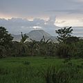
- Mount Mayapay: This mountain in Agusan del Norte is a notable landmark. It offers great views and is a part of the region's natural beauty.
Images for kids
-
Mount Mayapay in Agusan del Norte
See also
 In Spanish: Caraga para niños
 | Lonnie Johnson |
 | Granville Woods |
 | Lewis Howard Latimer |
 | James West |


