Carbon Hill, Ohio facts for kids
Quick facts for kids
Carbon Hill, Ohio
|
|
|---|---|

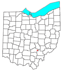
Location of Carbon Hill, Ohio
|
|
| Country | United States |
| State | Ohio |
| County | Hocking |
| Township | Ward |
| Area | |
| • Total | 0.41 sq mi (1.05 km2) |
| • Land | 0.41 sq mi (1.05 km2) |
| • Water | 0.00 sq mi (0.01 km2) |
| Elevation | 702 ft (214 m) |
| Population
(2020)
|
|
| • Total | 178 |
| • Density | 439.51/sq mi (169.90/km2) |
| Time zone | UTC-5 (Eastern (EST)) |
| • Summer (DST) | UTC-4 (EDT) |
| ZIP code |
43111
|
| Area code(s) | 740 |
| FIPS code | 39-12056 |
| GNIS feature ID | 2628873 |
Carbon Hill is a small place in Hocking County, Ohio, United States. It is not a city or town with its own government. Instead, it is called an unincorporated community. This means it is part of a larger area, in this case, Ward Township.
Carbon Hill is also a census-designated place (CDP). This is a special area that the government defines for counting people during a census. It helps them gather information about how many people live there.
Carbon Hill has its own post office with the ZIP code 43111. In the year 2020, about 178 people lived in Carbon Hill.
The main road in Carbon Hill is State Route 278. It runs along the western side of the community. Carbon Hill is about 3 miles (4.8 km) north of a larger town called Nelsonville.
Contents
History of Carbon Hill
Carbon Hill was first set up in the year 1873. The name "Carbon Hill" comes from an important industry that used to be there.
Mining for Coal
A lot of coal was dug up, or mined, in Carbon Hill. Coal is a type of rock that can be burned for energy. It is known as a carbon-based fuel because it is made mostly of carbon. This mining industry was very important to the community. It is why the place was named Carbon Hill.
Post Office Opens
The post office in Carbon Hill has been open for a long time. It started helping people send and receive mail in 1879.
Public Services for Residents
The people who live in Carbon Hill get their public services from nearby areas.
Schools in the Area
Students living in Carbon Hill go to schools that are part of the Nelsonville-York City School District. Older students attend Nelsonville-York High School.
Population Facts
The number of people living in Carbon Hill is counted regularly.
How Many People Live Here?
According to the 2020 census, the population of Carbon Hill was 178 people.
See also

- In Spanish: Carbon Hill (Ohio) para niños
 | Victor J. Glover |
 | Yvonne Cagle |
 | Jeanette Epps |
 | Bernard A. Harris Jr. |

