Cardonia, Indiana facts for kids
Quick facts for kids
Cardonia
|
|
|---|---|
| Country | United States |
| State | Indiana |
| County | Clay |
| Township | Van Buren |
| Elevation | 682 ft (208 m) |
| ZIP code |
47834
|
| FIPS code | 18-10234 |
| GNIS feature ID | 432127 |
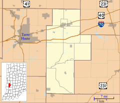
Cardonia is a small place in Indiana, United States, that doesn't have its own local government. It's called an unincorporated community. Think of it like a neighborhood or a small village that's part of a bigger area. Cardonia is located within Van Buren Township in Clay County. It's also considered part of the Terre Haute Metropolitan Statistical Area, which means it's connected to the larger city of Terre Haute.
A Look Back in Time
Cardonia was started a long time ago, in the year 1871. It was built because of coal mining! Back then, many towns were created just for mining coal, and Cardonia was one of them. It got its name from a mining official named John F. Card.
A post office was opened in Cardonia in 1879. This was important because it helped people send and receive letters and packages. However, the post office eventually closed down in 1909.
Where is Cardonia?
Cardonia is located in Indiana. You can find its exact spot using special numbers called coordinates: 39°33′42″N 87°06′28″W / 39.56167°N 87.10778°W. These numbers tell you its latitude (how far north or south it is) and longitude (how far east or west it is) on a map.
 | Frances Mary Albrier |
 | Whitney Young |
 | Muhammad Ali |


