Catalan Coastal Depression facts for kids
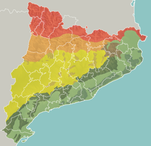
The Catalan Coastal Depression, known in Catalan as Depressió Litoral Catalana, is a long, flat area of land. It sits between the Catalan Pre-Coastal Range mountains and the Mediterranean Sea. Think of it like a long valley or a lower area of land. This depression is an important part of the larger Catalan Mediterranean System.
Where is the Catalan Coastal Depression?
This natural depression stretches for about 300 kilometers (186 miles). It generally runs from the northeast to the southwest. It is about 20 kilometers (12 miles) wide on average.
Many important cities in Catalonia are found in this area. It passes through several regions, called comarques, including:
- Empordà
- Gironès
- Selva
- Maresme
- Vallès
- Barcelonès
- Baix Llobregat
- Penedès
- Tarragonès
- Baix Camp
- Baix Ebre
Nature and Environment
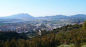
A large part of the Catalan Coastal Depression has been affected by human activity. This is mainly due to something called urban sprawl. Urban sprawl happens when cities and towns grow outwards, taking up more land. This growth can lead to changes in the natural environment.
See also
 In Spanish: Depresión Litoral Catalana para niños
 | Georgia Louise Harris Brown |
 | Julian Abele |
 | Norma Merrick Sklarek |
 | William Sidney Pittman |


