Cedro, New Mexico facts for kids
Quick facts for kids
Cedro, New Mexico
|
|
|---|---|

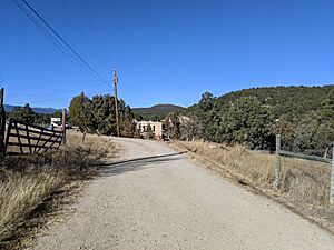
El Cedro Lane
|
|
| Country | United States |
| State | New Mexico |
| County | Bernalillo |
| Area | |
| • Total | 5.39 sq mi (13.97 km2) |
| • Land | 5.39 sq mi (13.97 km2) |
| • Water | 0.00 sq mi (0.00 km2) |
| Elevation | 7,241 ft (2,207 m) |
| Population
(2020)
|
|
| • Total | 416 |
| • Density | 77.15/sq mi (29.79/km2) |
| Time zone | UTC-7 (Mountain (MST)) |
| • Summer (DST) | UTC-6 (MDT) |
| Area code(s) | 505 |
| FIPS code | 35-13450 |
| GNIS feature ID | 2584071 |
Cedro is a small community in Bernalillo County, New Mexico, United States. It is called a census-designated place (CDP). This means it's an area that the U.S. Census Bureau defines for gathering population data. In 2010, about 430 people lived there. Cedro is part of the larger Albuquerque area.
Where is Cedro Located?
Cedro is in the eastern part of Bernalillo County. It is next to another community called Ponderosa Pine to the south. Cedro is in Cedro Canyon, which is at the northern end of the Manzano Mountains. These mountains are southeast of the city of Albuquerque.
New Mexico State Road 337 goes through Cedro Canyon and the community itself. This road leads north about 6 miles (10 km) to Tijeras. From Tijeras, you can take Interstate 40 about 14 miles (23 km) west to reach downtown Albuquerque.
The United States Census Bureau says that Cedro covers a total area of about 5.3 square miles (13.8 square kilometers). All of this area is land.
How Many People Live in Cedro?
| Historical population | |||
|---|---|---|---|
| Census | Pop. | %± | |
| 2020 | 416 | — | |
| U.S. Decennial Census | |||
The number of people living in Cedro changes over time. The U.S. Census Bureau counts the population every ten years. In 2020, there were 416 people living in Cedro.
Schools in Cedro
Students in Cedro attend schools that are part of the Albuquerque Public Schools system.
See also
 In Spanish: Cedro (Nuevo México) para niños
 | Valerie Thomas |
 | Frederick McKinley Jones |
 | George Edward Alcorn Jr. |
 | Thomas Mensah |


