
Bernalillo County, New Mexico facts for kids
Quick facts for kids
Bernalillo County
|
|||
|---|---|---|---|

Bernalillo County Courthouse in Albuquerque
|
|||
|
|||

Location within the U.S. state of New Mexico
|
|||
 New Mexico's location within the U.S. |
|||
| Country | |||
| State | |||
| Founded | 1852 | ||
| Seat | Albuquerque | ||
| Largest city | Albuquerque | ||
| Area | |||
| • Total | 1,167 sq mi (3,020 km2) | ||
| • Land | 1,161 sq mi (3,010 km2) | ||
| • Water | 6.4 sq mi (17 km2) 0.5%% | ||
| Population
(2020)
|
|||
| • Total | 676,444 | ||
| • Density | 580/sq mi (220/km2) | ||
| Time zone | UTC−7 (Mountain) | ||
| • Summer (DST) | UTC−6 (MDT) | ||
| Congressional districts | 1st, 2nd | ||


Bernalillo County is the county with the most people in the state of New Mexico. In 2020, about 676,444 people lived here. The main city and county center is Albuquerque, which is also the biggest city in New Mexico. Bernalillo County is the heart of the larger Albuquerque area.
Contents
History of Bernalillo County
Bernalillo County was one of the first areas set up when New Mexico was under Mexican rule. In 1852, it became one of the first nine counties in the New Mexico Territory. The county was named after the town of Bernalillo, even though that town is no longer in Bernalillo County today.
The towns of Los Ranchos de Albuquerque and Bernalillo used to be the main county centers. But in 1883, Albuquerque became the permanent county seat. In 1876, another area called Santa Ana County joined Bernalillo County.
Later, in 1906, parts of Bernalillo County became protected forest areas, now known as Cibola National Forest. A special ship from World War II, the USS LST-306, was even renamed USS Bernalillo County in 1955. Also, the Sandia Mountain Wilderness was created in 1978, and the Petroglyph National Monument was set up in 1990.
Geography of Bernalillo County
Bernalillo County covers about 1,167 square miles. Most of this area is land, with only a small part being water. It is the third-smallest county in New Mexico by size.
This county is in the middle of New Mexico. It stretches from the East Mountain area, which is just east of the Sandia Mountains, all the way to the Volcano Cliffs on the west side.
Neighboring Counties
Bernalillo County shares borders with these other counties:
- Sandoval County to the north
- Santa Fe County to the east
- Torrance County to the east
- Valencia County to the south
- Cibola County to the west
Protected Natural Areas
Several important natural and historical areas are found in Bernalillo County:
- Cibola National Forest (part of it)
- El Camino Real de Tierra Adentro National Historic Trail (part of it)
- Petroglyph National Monument
Population and People

In 2020, Bernalillo County had a population of 676,444 people. The county has grown a lot over the years. For example, in 1850, there were only about 7,751 people living here.
The people living in Bernalillo County come from many different backgrounds. Many residents have Hispanic or Latino roots.
Communities in Bernalillo County

It's interesting to know that the town of Bernalillo, which is north of Albuquerque, is actually not in Bernalillo County! When the county was first created in 1852, it was named after this town. But in 1903, the town of Bernalillo became part of Sandoval County.
Here are some of the places you can find in Bernalillo County:
Cities
- Albuquerque (3) (This is the county seat)
- Rio Rancho (part of this city is in Bernalillo County)
Town
- Edgewood (part of this town is in Bernalillo County)
Villages
- Los Ranchos de Albuquerque (1)
- Tijeras (6)
Census-Designated Places (CDPs)
These are areas that are like towns but are not officially incorporated as cities or villages.
- Barton
- Carnuel (9)
- Cedar Crest (5)
- Cedro
- Chilili (8)
- Edith Enclave
- Isleta (7)
- Kirtland AFB
- Manzano Springs (part of it)
- North Valley (2)
- Paa-Ko
- Pajarito Mesa
- Paradise Hills
- Ponderosa Pine
- San Antonito
- Sandia Heights
- Sandia Knolls
- Sandia Park
- Sedillo
- South Valley (4)
Unincorporated Communities
These are smaller areas that are not officially part of any city or village.
- Alameda
- Isleta Pueblo
- Laguna Pueblo
- Sandia Pueblo (part of it)
- Zuzax
Education in Bernalillo County
There are several school districts that serve the students in Bernalillo County:
- Albuquerque Public Schools
- Moriarty Municipal Schools
- Rio Rancho Public Schools
There are also schools run by the Bureau of Indian Education (BIE):
- Isleta Elementary School
- Albuquerque Indian School (This school is now closed)
The Southwestern Indian Polytechnic Institute (SIPI) is a college for Native American students. It is also located in an area of the county that is not part of a city or town.
Images for kids
-
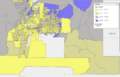
Median Household Income by Census Tract Block Group across Albuquerque metro.
See also
 In Spanish: Condado de Bernalillo para niños
