
Edgewood, New Mexico facts for kids
Quick facts for kids
Edgewood, New Mexico
|
|
|---|---|
 |
|
| Motto(s):
"Where the Mountains Meet the Plains"
|
|

Location of Edgewood, New Mexico
|
|
| Country | United States |
| State | New Mexico |
| County | Santa Fe |
| Government | |
| • Type | Commission-Manager system |
| Area | |
| • Total | 56.81 sq mi (147.15 km2) |
| • Land | 56.80 sq mi (147.10 km2) |
| • Water | 0.02 sq mi (0.05 km2) |
| Elevation | 6,687 ft (2,038 m) |
| Population
(2025)
|
|
| • Total | 6,500 |
| • Density | 114.44/sq mi (44.17/km2) |
| Time zone | UTC-7 (Mountain (MST)) |
| • Summer (DST) | UTC-6 (MDT) |
| ZIP code |
87015
|
| Area code(s) | 505 |
| FIPS code | 35-22380 |
| GNIS feature ID | 2412467 |
Edgewood is a town in New Mexico, United States. It is mostly located in Santa Fe County. However, parts of the town also reach into Bernalillo and Torrance counties.
Even though it's in Santa Fe County, Edgewood is actually closer to the bigger city of Albuquerque than to the city of Santa Fe. This town has grown a lot! Its population almost doubled between 2000 and 2010, growing from 1,893 to 3,735 people.
Contents
Discover the History of Edgewood, New Mexico
Early settlers, called homesteaders, came to this area in the late 1800s and early 1900s. They used special laws to claim land and started farms and ranches. This is how Edgewood first began.
The town of Edgewood was officially started in 1999 by people who lived and owned land in southern Santa Fe County. After it became a town, Edgewood added more land to its borders. Sometimes, adding new land caused discussions, but the town continued to grow.
Exploring the Geography of Edgewood
Edgewood is located about 33 miles (53 km) east of Albuquerque. You can find it along Interstate 40, a major highway.
The town covers a total area of about 56.81 square miles (147.15 square kilometers). Most of this area is land, with only a tiny bit of water. Edgewood is in the Estancia Valley, which is east of the Sandia Mountains and Manzano Mountains. These are large mountain ranges in central New Mexico.
Most of the land around Edgewood is covered by woodlands or grasslands. The main business area of the town is found along New Mexico Highway 66 and Highway 344. Highway 66 is part of the famous historic U.S. Route 66.
Understanding Edgewood's Population Growth
| Historical population | |||
|---|---|---|---|
| Census | Pop. | %± | |
| 2000 | 1,893 | — | |
| 2010 | 3,735 | 97.3% | |
| 2020 | 6,174 | 65.3% | |
| U.S. Decennial Census | |||
Edgewood is part of a larger group of cities and towns called the Albuquerque–Santa Fe–Las Vegas combined statistical area. This means it's connected to the economic and social life of these bigger cities.
The town has seen significant growth in its population over the years. For example, between 2000 and 2010, the number of people living in Edgewood nearly doubled! This shows that more and more families are choosing to make Edgewood their home.
Education in Edgewood, New Mexico
Students in Edgewood attend different school districts depending on where they live.
- The Moriarty-Edgewood School District serves most of Edgewood, especially the parts in Santa Fe County.
- If you live in the Bernalillo County part of Edgewood, you would go to Albuquerque Public Schools.
- There is also a charter school called Estancia Valley Classical Academy. This school teaches students from kindergarten all the way through 12th grade.
Famous People from Edgewood
Some well-known individuals have connections to Edgewood:
- Jason Anderson - A champion motorcyclist who won the AMA Monster Energy Supercross in 2018.
- Donald "Cowboy" Cerrone - A professional mixed martial artist born in 1983.
- John Dodson - Another MMA fighter who grew up in the area, including Edgewood.
- Matt Moore - A professional baseball pitcher who plays in Major League Baseball.
Images for kids
-
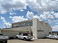
The Edgewood Public Library.
-
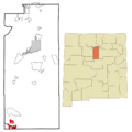
A map showing Edgewood's location in New Mexico.
See also
 In Spanish: Edgewood (Nuevo México) para niños
