San Antonito, Bernalillo County, New Mexico facts for kids
Quick facts for kids
San Antonito, New Mexico
|
|
|---|---|
|
Census-designated place
|
|

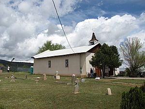
San Antonito Church
|
|
| Country | United States |
| State | New Mexico |
| County | Bernalillo |
| Area | |
| • Total | 2.445 sq mi (6.33 km2) |
| • Land | 2.445 sq mi (6.33 km2) |
| • Water | 0 sq mi (0 km2) |
| Elevation | 6,861 ft (2,091 m) |
| Population
(2010)
|
|
| • Total | 985 |
| • Density | 402.86/sq mi (155.55/km2) |
| Time zone | UTC-7 (Mountain (MST)) |
| • Summer (DST) | UTC-6 (MDT) |
| ZIP code |
87047
|
| Area code(s) | 505 |
| GNIS feature ID | 2584200 |
San Antonito is a small community in Bernalillo County, New Mexico, United States. It's called a census-designated place because it's a special area used for counting people by the government. In 2010, about 985 people lived there.
What San Antonito is Like
San Antonito is home to the San Antonito Church and Cemetery. This church and its cemetery are very important. They are listed on the National Register of Historic Places. This means they are recognized for their special historical value in the United States.
Learning in San Antonito
Students living in San Antonito go to schools that are part of the Albuquerque Public Schools system. This is the main school district for the city of Albuquerque and nearby areas.
More to Explore
- In Spanish: San Antonito (condado de Bernalillo) para niños
Black History Month on Kiddle
Famous African-American Inventors:
 | Valerie Thomas |
 | Frederick McKinley Jones |
 | George Edward Alcorn Jr. |
 | Thomas Mensah |

All content from Kiddle encyclopedia articles (including the article images and facts) can be freely used under Attribution-ShareAlike license, unless stated otherwise. Cite this article:
San Antonito, Bernalillo County, New Mexico Facts for Kids. Kiddle Encyclopedia.

