Cerro Kamuk facts for kids
Quick facts for kids Cerro Kamuk |
|
|---|---|
| Highest point | |
| Elevation | 3,549 m (11,644 ft) |
| Geography | |
| Location | Costa Rica |
| Parent range | Cordillera de Talamanca |
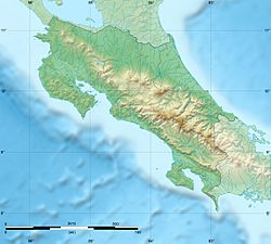
Cerro Kamuk, also known as Cerro Pico Blanco, is a very tall mountain in Costa Rica. It is located in the eastern part of the country, close to the border with Panama. This impressive peak is part of the Talamanca mountain range.
Cerro Kamuk stands at about 3,549 meters (11,644 feet) above sea level. This makes it one of the highest mountains in all of Central America! The area around the mountain is protected within La Amistad International Park. This park is so special that UNESCO (the United Nations Educational, Scientific and Cultural Organization) named it a natural World Heritage Site in 1983. This means it's a place of great importance to everyone on Earth.
Local indigenous groups, like the Bribris and Cabecar, have lived in this region for a very long time. Cerro Kamuk is also part of the Mesoamerican Biological Corridor. This is a big project involving eight Central American countries. Its goal is to protect the beautiful mountain forests and amazing wildlife found in Central America.
Contents
Exploring Cerro Kamuk: A Mountain Adventure
If you love adventure, you might be interested in hiking to the top of Cerro Kamuk! There is a special trail that leads to the peak. This trail starts in a small community called Tres Colinas. You can reach Tres Colinas by a four-wheel-drive vehicle from the town of Portero Grande.
How to Access the Trail
The community group called Asotur Tres Colinas helps manage access to the trail. The National System of Conservation Areas (SINAC) also has a station nearby. The hike is quite long, about 55 kilometers (34 miles) round trip.
Camping Along the Way
Along the trail, there are three special areas where you can set up camp:
- Camp 1: This camp is about 10 kilometers (6 miles) into the hike, next to a small creek.
- Camp 2: You'll find this camp around 18 kilometers (11 miles) in, also by a creek.
- Camp 3: The last camp is at about 25 kilometers (15 miles). The very top of the mountain is just 2.5 kilometers (1.5 miles) further!
Asotur Tres Colinas requires all hiking groups to have a guide when entering the park using the Cerro Kamuk trail. This helps keep everyone safe and protects the park. The trail follows a ridge and goes over several other peaks before reaching Kamuk. Remember, water is easiest to find at the designated camp areas.
Amazing Plants and Animals of Cerro Kamuk
The journey to Cerro Kamuk is like walking through different natural worlds. The trail starts in areas that used to be farms but are now growing back into forests.
Forests and Unique Plants
As you go higher, you enter a montane oak forest. This forest is full of epiphytes, which are plants that grow on other plants, like trees, but don't harm them. They get their water and nutrients from the air and rain. Even higher up, the trail goes through wet, spongy areas called peat bogs. Finally, you reach a special type of grassland called páramo. You'll also see a lot of Chusquea bamboo along the trail, especially at higher elevations.
Wildlife You Might See
The area around Cerro Kamuk is home to many incredible animals. If you're lucky, you might spot some amazing creatures like:
This rich variety of plants and animals makes Cerro Kamuk a truly special place for nature lovers!
See also
 In Spanish: Cerro Kamuk para niños
 | Percy Lavon Julian |
 | Katherine Johnson |
 | George Washington Carver |
 | Annie Easley |


