
Chalkland Way facts for kids
Quick facts for kids The Chalkland Way |
|
|---|---|

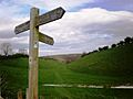
Fingerpost pointing out the direction of Chalkland Way
|
|
| Length | 40.8 mi (65.7 km) |
| Location | North Yorkshire East Riding of Yorkshire, England |
| Use | Hiking |
| Highest point | 787 ft (240 m) |
| Difficulty | Challenging |
| Hazards | Road crossings Steep ascents and descents Stiles and gates Uneven surfaces |
The Chalkland Way is an exciting circular walking path in East Riding of Yorkshire and North Yorkshire, England. This trail is about 40-mile (64 km) (64 kilometers) long. It takes you through the beautiful chalky hills and valleys of the western Yorkshire Wolds. Many people start this adventure in the town of Pocklington.
Contents
The Chalkland Way: A Great Adventure
What is The Chalkland Way?
The Chalkland Way is a special path designed for hikers. It goes in a big circle, so you end up back where you started. The path is known for its stunning views of the countryside. It's a great way to explore the natural beauty of Yorkshire.
How The Trail Started
The Chalkland Way was first created by a person named Ray Wallis in 1994. He wanted to make a clear path for people to enjoy. The official symbol for the trail is a black swan on a green background. This badge also has the walk's name and "Ramblers Association" written on it. The Ramblers are a group that helps people enjoy walking.
Exploring The Route
The Chalkland Way crosses paths with several other long-distance walking routes. These include the Yorkshire Wolds National Trail, the Centenary Way (North Yorkshire), the Minster Way, and the Wilberforce Way. This means you might see signs for other trails along your journey!
Key Places Along the Way
If you start from Pocklington and walk clockwise, the path first heads north-east. It soon leaves the town and goes across open fields. You will walk through areas like Pocklington Wood. The path then turns west and north, crossing more fields.
One part of the trail climbs through Grimthorpe Wood. It reaches a high point called Great Givendale, which is about 486 feet (148 m) (486 feet) high. Here, the Chalkland Way joins up with the Minster Way for a bit.
The route continues through the village of Bishop Wilton. After that, it leaves the Minster Way near Youlthorpe. You will cross the A166 and pass close to a village called Bugthorpe.
The path then turns mostly east, going through fields and past farms. It briefly joins the Centenary Way near Thixendale. After Thixendale, the route heads south-east. It passes through a small place called Fimber.
You will then cross more farmland to reach the village of Wetwang. This village is also on the A166. Leaving Wetwang, the path curves south and then west towards Huggate. It goes around the northern edge of Huggate before entering some woodland.
The trail then turns south and joins the Minster Way again near Millington Wood. Finally, it passes north of Kilnwick Percy. The path then connects back to the starting point south of Pocklington Wood. This brings you back to the Market Place in Pocklington, completing your circular walk.
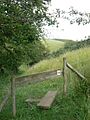
Images for kids
-
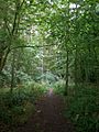
The Chalkland Way through Pocklington Wood
-
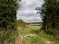
The Chalkland Way, north east of Bugthorpe
-
The Chalkland Way ascends Thixen Dale
-
Chalkland Way above Horsedale
-
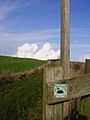
Junction of the Yorkshire Wolds Way with the Chalkland Way
-
Along the Chalkland Way above Millington Dale
-
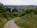
The Chalkland Way into Pocklington


