Chemung, Illinois facts for kids
Quick facts for kids
Chemung, Illinois
|
|
|---|---|
| Country | |
| State | |
| County | McHenry |
| Townships | Chemung, Dunham |
| Area | |
| • Total | 0.28 sq mi (0.73 km2) |
| • Land | 0.28 sq mi (0.73 km2) |
| • Water | 0.00 sq mi (0.00 km2) |
| Elevation | 896 ft (273 m) |
| Population
(2020)
|
|
| • Total | 276 |
| • Density | 982.21/sq mi (379.10/km2) |
| Time zone | UTC-6 (CST) |
| • Summer (DST) | UTC-5 (CDT) |
| ZIP Code(s) |
60033
|
| FIPS code | 17-12879 |
| Wikimedia Commons | Chemung, Illinois |
Chemung is a small place in McHenry County, Illinois, United States. It's called an "unincorporated community" and a "census-designated place." This means it's a group of homes and businesses that isn't officially a town or city, but the government counts its population. Chemung is about 896 feet (273 meters) above sea level. In 2020, about 276 people lived there.
History of Chemung
Chemung got its own post office way back in 1845. It stayed open for many years until 1943. The name "Chemung" comes from a Native American word. It means "big horn." This name was chosen because a large fossil with horns was found in a river nearby.
Where is Chemung?
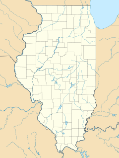
This small community is located in Illinois. It's about 3.14 miles west of a town called Harvard. Chemung is found where three roads meet: Illinois Route 173, Oak Grove Road, and Island Road.
The town sits right on the border between two areas called Chemung Township and Dunham Township. A creek called Piscasaw Creek flows along the west side of Chemung. Also, a Union Pacific Railroad train track runs through the town. Even though Chemung has its own history, people who live there get their mail from the Harvard post office. Chemung covers an area of about 0.28 square miles (0.73 square kilometers), and all of it is land.
People in Chemung
| Historical population | |||
|---|---|---|---|
| Census | Pop. | %± | |
| 2010 | 308 | — | |
| 2020 | 276 | −10.4% | |
| U.S. Decennial Census 2010 2020 |
|||
Chemung was first counted as a "census-designated place" in the 2010 U.S. Census. This means it was officially recognized for population counting purposes.
In 2010, the population of Chemung was 308 people. By 2020, the population had changed to 276 people. People from many different backgrounds live in Chemung.
See also
 In Spanish: Chemung (Illinois) para niños
 | Jessica Watkins |
 | Robert Henry Lawrence Jr. |
 | Mae Jemison |
 | Sian Proctor |
 | Guion Bluford |


