Chilkat Inlet facts for kids
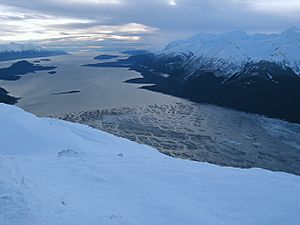
Chilkat Inlet is a narrow arm of the sea, like a small bay, located in Lynn Canal in the beautiful Southeast region of Alaska. It's where the Chilkat River flows into the sea, forming a delta. The inlet is close to the town of Haines and borders the Chilkat Peninsula.
The inlet was first mapped in 1794 by Joseph Whidbey. He was the captain of the ship HMS Discovery during George Vancouver's big trip around the world from 1791 to 1795.
A Place for Trade
Chilkat Inlet was an important spot for people involved in the maritime fur trade. These were traders who traveled by ship to buy and sell animal furs. They started visiting the inlet around 1800.
One ship called the Atahualpa came to Chilkat Inlet in 1801. Its records show that another ship had visited even earlier. The traders sometimes spelled "Chilkat" in different ways, like "Chilcart" or "Chilkark."
An Important Event in 1811
In April 1811, an American fur trader named Samuel Hill arrived at Chilkat Inlet. He was the captain of a ship called the Otter. There was a conflict between Captain Hill and the local Tlingit people.
During this event, some of Hill's crew members were killed or hurt. Captain Hill also reported that many Tlingit people were killed. After this conflict, fewer trading ships visited Chilkat Inlet for several years. However, by 1821, it became a regular trading place again. Ships like the Mentor visited that year.
 | James B. Knighten |
 | Azellia White |
 | Willa Brown |


