Lynn Canal facts for kids

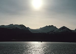
Lynn Canal is a long, narrow arm of the sea in southeast Alaska. It's a natural waterway, not a man-made canal. It stretches about 90 miles (145 km) from the Chilkat River south towards Chatham Strait and Stephens Passage.
Lynn Canal is super deep, more than 2,000 feet (610 meters)! This makes it one of the deepest and longest fjords in the world. It is also the deepest fjord in North America, not counting Greenland.
The northern part of the canal splits into three smaller inlets: Chilkat Inlet, Chilkoot Inlet, and Taiya Inlet.
Lynn Canal was explored by Joseph Whidbey in 1794. It was named by George Vancouver after his hometown, King's Lynn, in England.
Sailors involved in the maritime fur trade often visited Lynn Canal starting around 1800. For example, the ship Atahualpa came in 1801. Its logbook mentions another trading ship had been there even earlier.
Contents
Early Conflicts and Trade
In April 1811, an American fur trader named Samuel Hill had a battle with the Chilkat Tlingit people. This happened in the Chilkat Inlet of Lynn Canal. Two of Hill's crew members were killed, and six more were hurt. Captain Hill said that 40 Tlingit people were killed, including 13 chiefs. Hill was known for being violent and often attacked Native people without reason.
After this battle in 1811, fewer trade ships visited for several years. But by 1821, Lynn Canal was again a busy trading spot. Ships like the Mentor visited regularly.
Transportation in Lynn Canal
Lynn Canal is a very important waterway. It connects towns like Skagway and Haines to Juneau and the rest of the Inside Passage. This makes it a major route for cargo ships, cruise ships, and ferries.
Gold Rush Route
During the Klondike Gold Rush, Lynn Canal was a main path to the gold fields. Many people traveled through it to reach the boom towns of Skagway and Dyea. From there, they would go on to the Klondike gold fields.
A terrible shipping accident happened in Lynn Canal in October 1918. The SS Princess Sophia was sailing south from Skagway. It hit Vanderbilt Reef and later sank. All 343 passengers and crew members were lost. This was the worst maritime disaster in the history of the Pacific Northwest.
After the gold rush, the White Pass and Yukon Route railroad was built. This railroad carried ore and other goods from the Yukon Territory to Skagway's deepwater port. From Skagway, these goods were shipped through Lynn Canal. However, by the 1970s and 1980s, less freight was shipped. This was because mining activity in the area slowed down. Today, very little cargo is shipped in Lynn Canal.
Modern Travel and Safety
Today, the Alaska Marine Highway ferries provide most of the transportation in the canal. There are also some smaller water taxis and ferries. But the Alaska Marine Highway is used the most. There is also a plan for a Lynn Canal Highway, but its future is not certain.
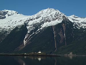
Because Lynn Canal is used so much, the United States Coast Guard built several lighthouses there in the early 1900s. These include Eldred Rock Light, Sentinel Island Light, and Point Sherman Light. These lighthouses help guide ships safely.
Boundary Dispute
Historically, Lynn Canal was part of an argument called the Alaska boundary dispute. This dispute was about a strip of land along the Pacific coast between British Columbia and Alaska. Lynn Canal was very important because it provided access to the Yukon, where gold was found in 1896.
The argument was between the United Kingdom (which controlled Canada's foreign relations at the time) and the United States. It was finally settled in 1903 by a group of arbitrators. They decided that Lynn Canal was part of Alaska, not British Columbia.
See also
 In Spanish: Canal de Lynn para niños
 | James B. Knighten |
 | Azellia White |
 | Willa Brown |


